

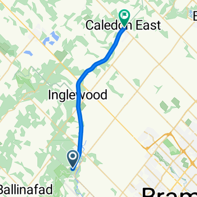
Caledon Trailway Path
A cycling route starting in Brampton, Ontario, Canada.
Overview
About this route
- -:--
- Duration
- 19 km
- Distance
- 48 m
- Ascent
- 36 m
- Descent
- ---
- Avg. speed
- 298 m
- Max. altitude

Route quality
Waytypes & surfaces along the route
Waytypes
Path
18.3 km
(96 %)
Access road
0.6 km
(3 %)
Quiet road
0.2 km
(1 %)
Surfaces
Paved
0.2 km
(1 %)
Unpaved
18.1 km
(95 %)
Loose gravel
18.1 km
(95 %)
Asphalt
0.2 km
(1 %)
Undefined
0.8 km
(4 %)
Continue with Bikemap
Use, edit, or download this cycling route
You would like to ride Caledon Trailway Path or customize it for your own trip? Here is what you can do with this Bikemap route:
Free features
- Save this route as favorite or in collections
- Copy & plan your own version of this route
- Sync your route with Garmin or Wahoo
Premium features
Free trial for 3 days, or one-time payment. More about Bikemap Premium.
- Navigate this route on iOS & Android
- Export a GPX / KML file of this route
- Create your custom printout (try it for free)
- Download this route for offline navigation
Discover more Premium features.
Get Bikemap PremiumFrom our community
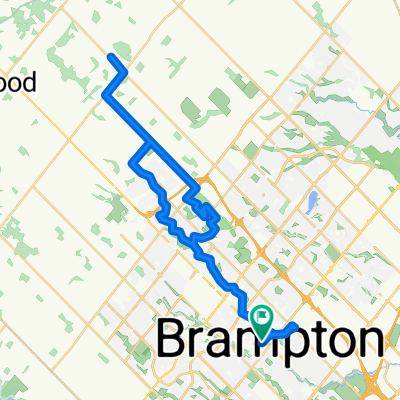
Other popular routes starting in Brampton
 Caledon Trailway Path
- Distance
- 19 km
- Ascent
- 48 m
- Descent
- 36 m
- Location
- Brampton, Ontario, Canada
 Shroom Zorp Bike
- Distance
- 26.8 km
- Ascent
- 321 m
- Descent
- 190 m
- Location
- Brampton, Ontario, Canada
 MSP to DARs
- Distance
- 86.9 km
- Ascent
- 310 m
- Descent
- 310 m
- Location
- Brampton, Ontario, Canada
 От Old Kennedy Road до Queens Quay West
- Distance
- 88.7 km
- Ascent
- 343 m
- Descent
- 378 m
- Location
- Brampton, Ontario, Canada
 501–533 Central Park Dr, Brampton to Central Park Dr, Brampton
- Distance
- 10.9 km
- Ascent
- 35 m
- Descent
- 34 m
- Location
- Brampton, Ontario, Canada
 Brampton GO Return to Dixie Orchards Via Etobicoke Creek and Herat Lake
- Distance
- 67.7 km
- Ascent
- 295 m
- Descent
- 293 m
- Location
- Brampton, Ontario, Canada
 Brampton GO Return to Dixie Orchards Via Etobicoke Creek and Herat Lake
- Distance
- 46.7 km
- Ascent
- 179 m
- Descent
- 178 m
- Location
- Brampton, Ontario, Canada
 Guelph Street, Halton Hills to Steeles Avenue East 370, Brampton
- Distance
- 12.8 km
- Ascent
- 4 m
- Descent
- 0 m
- Location
- Brampton, Ontario, Canada
Open it in the app