

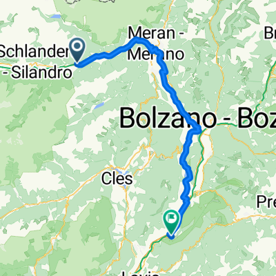
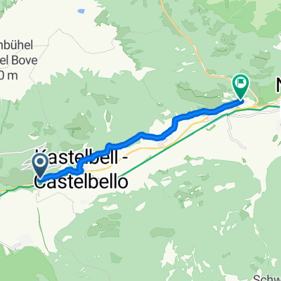
Kastelbach_Freeridestrecke
A cycling route starting in Castelbello-Ciardes - Kastelbell-Tschars, Trentino-Alto Adige, Italy.
Overview
About this route
- -:--
- Duration
- 29.9 km
- Distance
- 1,248 m
- Ascent
- 1,249 m
- Descent
- ---
- Avg. speed
- ---
- Max. altitude
Continue with Bikemap
Use, edit, or download this cycling route
You would like to ride Kastelbach_Freeridestrecke or customize it for your own trip? Here is what you can do with this Bikemap route:
Free features
- Save this route as favorite or in collections
- Copy & plan your own version of this route
- Sync your route with Garmin or Wahoo
Premium features
Free trial for 3 days, or one-time payment. More about Bikemap Premium.
- Navigate this route on iOS & Android
- Export a GPX / KML file of this route
- Create your custom printout (try it for free)
- Download this route for offline navigation
Discover more Premium features.
Get Bikemap PremiumFrom our community
Other popular routes starting in Castelbello-Ciardes - Kastelbell-Tschars
 Radwandern Tschars-Naturns
- Distance
- 10.7 km
- Ascent
- 146 m
- Descent
- 172 m
- Location
- Castelbello-Ciardes - Kastelbell-Tschars, Trentino-Alto Adige, Italy
 03.10.2024
- Distance
- 27.4 km
- Ascent
- 148 m
- Descent
- 396 m
- Location
- Castelbello-Ciardes - Kastelbell-Tschars, Trentino-Alto Adige, Italy
 Kastelbach_Freeridestrecke
- Distance
- 29.9 km
- Ascent
- 1,248 m
- Descent
- 1,249 m
- Location
- Castelbello-Ciardes - Kastelbell-Tschars, Trentino-Alto Adige, Italy
 5.Etappe Castelbello - Salorno
- Distance
- 86.2 km
- Ascent
- 197 m
- Descent
- 555 m
- Location
- Castelbello-Ciardes - Kastelbell-Tschars, Trentino-Alto Adige, Italy
 via_vinum_venostis_179644104
- Distance
- 8.2 km
- Ascent
- 312 m
- Descent
- 216 m
- Location
- Castelbello-Ciardes - Kastelbell-Tschars, Trentino-Alto Adige, Italy
 Etschradweg
- Distance
- 102 km
- Ascent
- 73 m
- Descent
- 512 m
- Location
- Castelbello-Ciardes - Kastelbell-Tschars, Trentino-Alto Adige, Italy
 Vin - höhe
- Distance
- 67.7 km
- Ascent
- 1,127 m
- Descent
- 1,090 m
- Location
- Castelbello-Ciardes - Kastelbell-Tschars, Trentino-Alto Adige, Italy
 Mals im Vinschgau
- Distance
- 75.5 km
- Ascent
- 813 m
- Descent
- 799 m
- Location
- Castelbello-Ciardes - Kastelbell-Tschars, Trentino-Alto Adige, Italy
Open it in the app