

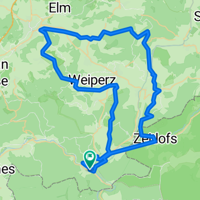
Route from Honigrückweg 2, Sinntal
A cycling route starting in Obersinn, Bavaria, Germany.
Overview
About this route
- 1 h 39 min
- Duration
- 29.1 km
- Distance
- 407 m
- Ascent
- 472 m
- Descent
- 17.6 km/h
- Avg. speed
- ---
- Max. altitude

Route quality
Waytypes & surfaces along the route
Waytypes
Track
11.3 km
(39 %)
Busy road
9.5 km
(32 %)
Surfaces
Paved
28.2 km
(97 %)
Asphalt
25.9 km
(89 %)
Paving stones
1.2 km
(4 %)
Continue with Bikemap
Use, edit, or download this cycling route
You would like to ride Route from Honigrückweg 2, Sinntal or customize it for your own trip? Here is what you can do with this Bikemap route:
Free features
- Save this route as favorite or in collections
- Copy & plan your own version of this route
- Sync your route with Garmin or Wahoo
Premium features
Free trial for 3 days, or one-time payment. More about Bikemap Premium.
- Navigate this route on iOS & Android
- Export a GPX / KML file of this route
- Create your custom printout (try it for free)
- Download this route for offline navigation
Discover more Premium features.
Get Bikemap PremiumFrom our community
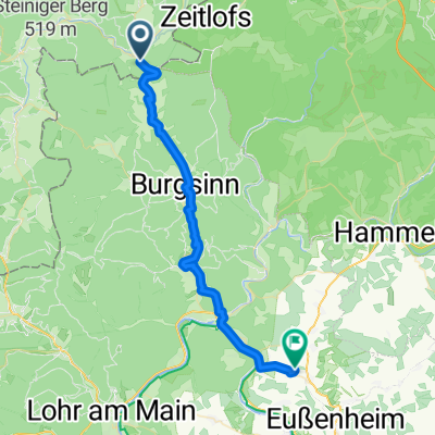
Other popular routes starting in Obersinn
 Climb ´em all
- Distance
- 53.4 km
- Ascent
- 1,030 m
- Descent
- 1,030 m
- Location
- Obersinn, Bavaria, Germany
 Route from Honigrückweg 2, Sinntal
- Distance
- 29.1 km
- Ascent
- 407 m
- Descent
- 472 m
- Location
- Obersinn, Bavaria, Germany
 Tour de Bayerisch Schanz
- Distance
- 73.2 km
- Ascent
- 1,275 m
- Descent
- 1,230 m
- Location
- Obersinn, Bavaria, Germany
 2013 Jossa-Morlesau (Sinntal-Fränkische Saale)
- Distance
- 55.4 km
- Ascent
- 201 m
- Descent
- 239 m
- Location
- Obersinn, Bavaria, Germany
 Rhönexpress: Altengronau - Wildflecken
- Distance
- 31.7 km
- Ascent
- 443 m
- Descent
- 133 m
- Location
- Obersinn, Bavaria, Germany
 Jossa-Gemünde-Jossa (Sinntal)
- Distance
- 87.2 km
- Ascent
- 552 m
- Descent
- 552 m
- Location
- Obersinn, Bavaria, Germany
 2009 Jossa-Werntal
- Distance
- 35 km
- Ascent
- 155 m
- Descent
- 245 m
- Location
- Obersinn, Bavaria, Germany
 Besuch an der Buhne
- Distance
- 72.7 km
- Ascent
- 511 m
- Descent
- 511 m
- Location
- Obersinn, Bavaria, Germany
Open it in the app