

Tag1_CAAR-V1x
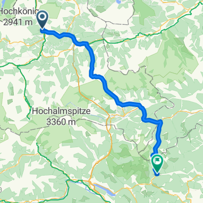
A cycling route starting in Pfarrwerfen, Salzburg, Austria.
Overview
About this route
- -:--
- Duration
- 91.4 km
- Distance
- 3,527 m
- Ascent
- 3,432 m
- Descent
- ---
- Avg. speed
- 2,648 m
- Max. altitude

Route quality
Waytypes & surfaces along the route
Waytypes
Quiet road
40.2 km
(44 %)
Cycleway
21 km
(23 %)
Surfaces
Paved
44.8 km
(49 %)
Unpaved
14.6 km
(16 %)
Asphalt
44.8 km
(49 %)
Loose gravel
10.1 km
(11 %)
Continue with Bikemap
Use, edit, or download this cycling route
You would like to ride Tag1_CAAR-V1x or customize it for your own trip? Here is what you can do with this Bikemap route:
Free features
- Save this route as favorite or in collections
- Copy & plan your own version of this route
- Split it into stages to create a multi-day tour
- Sync your route with Garmin or Wahoo
Premium features
Free trial for 3 days, or one-time payment. More about Bikemap Premium.
- Navigate this route on iOS & Android
- Export a GPX / KML file of this route
- Create your custom printout (try it for free)
- Download this route for offline navigation
Discover more Premium features.
Get Bikemap PremiumFrom our community
Other popular routes starting in Pfarrwerfen
 2 Pfarwerfen- Bad Gastein- Camp Erlengrund
- Distance
- 53.2 km
- Ascent
- 1,292 m
- Descent
- 971 m
- Location
- Pfarrwerfen, Salzburg, Austria
 Ostpreussenhütte
- Distance
- 8.2 km
- Ascent
- 1,012 m
- Descent
- 123 m
- Location
- Pfarrwerfen, Salzburg, Austria
 A-A 2, bad Gastein 48km
- Distance
- 47.9 km
- Ascent
- 749 m
- Descent
- 437 m
- Location
- Pfarrwerfen, Salzburg, Austria
 Von Pfarrwerfen nach Eben im Pongau zum Ennsradweg
- Distance
- 21.6 km
- Ascent
- 353 m
- Descent
- 26 m
- Location
- Pfarrwerfen, Salzburg, Austria
 (ursprünglich geplant) Bischofshofen - Obertauern - Turracher Höhe - Reichenau CLONED FROM ROUTE 460010
- Distance
- 117 km
- Ascent
- 2,085 m
- Descent
- 1,584 m
- Location
- Pfarrwerfen, Salzburg, Austria
 Vorbereitung 2.Tag
- Distance
- 51.3 km
- Ascent
- 428 m
- Descent
- 436 m
- Location
- Pfarrwerfen, Salzburg, Austria
 Tag1_CAAR-V1x
- Distance
- 91.4 km
- Ascent
- 3,527 m
- Descent
- 3,432 m
- Location
- Pfarrwerfen, Salzburg, Austria
 Recovered Route
- Distance
- 16.3 km
- Ascent
- 123 m
- Descent
- 81 m
- Location
- Pfarrwerfen, Salzburg, Austria
Open it in the app