

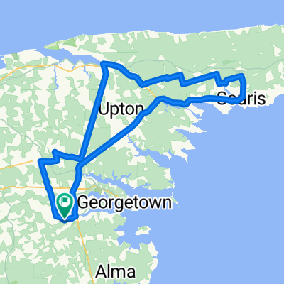
Cardigan montague 1
A cycling route starting in Montague, Prince Edward Island, Canada.
Overview
About this route
- -:--
- Duration
- 34.1 km
- Distance
- 140 m
- Ascent
- 145 m
- Descent
- ---
- Avg. speed
- 41 m
- Max. altitude

Route quality
Waytypes & surfaces along the route
Waytypes
Road
18.7 km
(55 %)
Cycleway
10.2 km
(30 %)
Surfaces
Paved
23.2 km
(68 %)
Unpaved
0.7 km
(2 %)
Paved (undefined)
19.8 km
(58 %)
Asphalt
3.4 km
(10 %)
Continue with Bikemap
Use, edit, or download this cycling route
You would like to ride Cardigan montague 1 or customize it for your own trip? Here is what you can do with this Bikemap route:
Free features
- Save this route as favorite or in collections
- Copy & plan your own version of this route
- Sync your route with Garmin or Wahoo
Premium features
Free trial for 3 days, or one-time payment. More about Bikemap Premium.
- Navigate this route on iOS & Android
- Export a GPX / KML file of this route
- Create your custom printout (try it for free)
- Download this route for offline navigation
Discover more Premium features.
Get Bikemap PremiumFrom our community
Other popular routes starting in Montague
 Knox Dam to Georgetown, Cardigan
- Distance
- 54.3 km
- Ascent
- 233 m
- Descent
- 233 m
- Location
- Montague, Prince Edward Island, Canada
 169–199 Oldis Rd, St. Andrew's Parish to 4989 A A MacDonald Hwy, St. George's Parish
- Distance
- 17.2 km
- Ascent
- 115 m
- Descent
- 100 m
- Location
- Montague, Prince Edward Island, Canada
 Route from 4653 Route 3, Vernon Bridge
- Distance
- 5.8 km
- Ascent
- 63 m
- Descent
- 56 m
- Location
- Montague, Prince Edward Island, Canada
 Knox Dam to Mount Stewart 2
- Distance
- 66.7 km
- Ascent
- 271 m
- Descent
- 271 m
- Location
- Montague, Prince Edward Island, Canada
 Jour 5 IDLM Brudenell River Provincial Park à Northumberland
- Distance
- 86.1 km
- Ascent
- 155 m
- Descent
- 163 m
- Location
- Montague, Prince Edward Island, Canada
 Knox Dam to Souris, St. Peters
- Distance
- 123.8 km
- Ascent
- 417 m
- Descent
- 417 m
- Location
- Montague, Prince Edward Island, Canada
 Cardigan montague 1
- Distance
- 34.1 km
- Ascent
- 140 m
- Descent
- 145 m
- Location
- Montague, Prince Edward Island, Canada
 Knox Dam to Mount Stewart 1
- Distance
- 79.8 km
- Ascent
- 310 m
- Descent
- 312 m
- Location
- Montague, Prince Edward Island, Canada
Open it in the app