2026_05_03_Molln-Steyrling_Retour
- 59.1 km
- 1,496 m
- 1,492 m
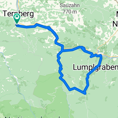
- Ternberg, Upper Austria, Austria
A cycling route starting in Ternberg, Upper Austria, Austria.
Overview
With a mountain bike, one can quite comfortably reach the beautiful summit of the Hohe Dirn, including a short walk. This is possible because many forest roads in the region between the Enns and Steyr valleys have now been opened to mountain biking. However, most literally leave the summit to the left and continue directly to the Anton Schosser Hut.
created this 5 years ago
Route quality
Track
19.8 km
68 %
Quiet road
5.5 km
19 %
Paved
0.9 km
(3 %)
Unpaved
21 km
(72 %)
Gravel
11.1 km
38 %
Unpaved (undefined)
9.9 km
34 %
Continue with Bikemap
You would like to ride Hohe Dirn (1134m) von Trattenbach or customize it for your own trip? Here is what you can do with this Bikemap route:
Free trial for 3 days, or one-time payment. More about Bikemap Premium.
Discover more Premium features.
Get Bikemap PremiumFrom our community
Open it in the app