

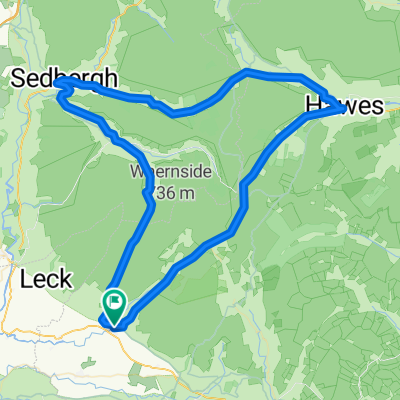
West Riding Classic
A cycling route starting in Ingleton, England, United Kingdom.
Overview
About this route
New for 2011. Includes Deepdale, Halton Fell and Malham Cove.
- -:--
- Duration
- 115.9 km
- Distance
- 1,391 m
- Ascent
- 1,388 m
- Descent
- ---
- Avg. speed
- ---
- Max. altitude

Route quality
Waytypes & surfaces along the route
Waytypes
Quiet road
82.3 km
(71 %)
Road
8.1 km
(7 %)
Surfaces
Paved
48.7 km
(42 %)
Asphalt
48.7 km
(42 %)
Undefined
67.2 km
(58 %)
Continue with Bikemap
Use, edit, or download this cycling route
You would like to ride West Riding Classic or customize it for your own trip? Here is what you can do with this Bikemap route:
Free features
- Save this route as favorite or in collections
- Copy & plan your own version of this route
- Split it into stages to create a multi-day tour
- Sync your route with Garmin or Wahoo
Premium features
Free trial for 3 days, or one-time payment. More about Bikemap Premium.
- Navigate this route on iOS & Android
- Export a GPX / KML file of this route
- Create your custom printout (try it for free)
- Download this route for offline navigation
Discover more Premium features.
Get Bikemap PremiumFrom our community
Other popular routes starting in Ingleton
 Kirkby Lonsdale to Kirkstone Pass
- Distance
- 42.9 km
- Ascent
- 742 m
- Descent
- 362 m
- Location
- Ingleton, England, United Kingdom
 Jogle Day 8
- Distance
- 90.2 km
- Ascent
- 843 m
- Descent
- 963 m
- Location
- Ingleton, England, United Kingdom
 West Riding Classic
- Distance
- 115.9 km
- Ascent
- 1,391 m
- Descent
- 1,388 m
- Location
- Ingleton, England, United Kingdom
 Day 3 kirby Lonsdale to morcombe, W2w te Settle
- Distance
- 83 km
- Ascent
- 434 m
- Descent
- 363 m
- Location
- Ingleton, England, United Kingdom
 Méandre autour les 3 pics en Yorkshire Dales
- Distance
- 78.6 km
- Ascent
- 846 m
- Descent
- 846 m
- Location
- Ingleton, England, United Kingdom
 Ingleton Kingsdale, Deepdale, Chapel Le Dale Circular
- Distance
- 44.7 km
- Ascent
- 751 m
- Descent
- 749 m
- Location
- Ingleton, England, United Kingdom
 Ingleton circle route
- Distance
- 36.7 km
- Ascent
- 352 m
- Descent
- 369 m
- Location
- Ingleton, England, United Kingdom
 clapham tunnels and bridges
- Distance
- 19.4 km
- Ascent
- 429 m
- Descent
- 425 m
- Location
- Ingleton, England, United Kingdom
Open it in the app