

Jaunbachschlucht in La Gruyère
A cycling route starting in Broc, Canton of Fribourg, Switzerland.
Overview
About this route
This famous hiking trail winds through the Jaunbach Gorge, with the stream that used to be called Jaunia – The Cold. In the heart of beautiful nature, the hiker discovers a refreshing, sometimes narrow path. The trail that runs along the shore connects the village of Broc with the Montsalvens dam. Thanks to the wooden bridges, tunnels, and galleries, this outing becomes an adventure for both young and old. Picnic spots are scattered along the entire route. Various sights are located along the way. In Broc, the stream flows at the height of the Swiss chocolate factory Maison Cailler into Lake Gruyères. At the beginning of the gorge, the Montsalvens dam is located. This structure was built in 1921 and is the first double-arch dam in Europe. From here, you can enjoy the panorama of the Jaun Valley and the Dents-Vertes in Charmey. Tip: Extend your hike and follow the path along the shore of Lake Montsalvens to Charmey. The Jaunbach Gorge is also part of the Chemin du Gruyère, which leads from Charmey to the medieval town of Gruyères. Accessible by public transport: Yes | Nearest stop: Broc, Le Home or Châtel-sur-Montsalvens, Restaurant. Accessible by car: Yes | Parking in Broc: 50m to the right after the village exit towards Charmey | Parking in Châtel-sur-Montsalvens: Opposite the restaurant de La Tour are some parking spaces reserved for hikers (Note: do not use the restaurant's parking spaces).
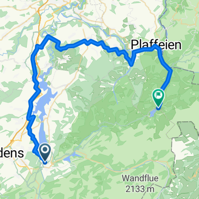
- 2 h 54 min
- Duration
- 1.7 km
- Distance
- 132 m
- Ascent
- 92 m
- Descent
- 0.6 km/h
- Avg. speed
- ---
- Max. altitude

Continue with Bikemap
Use, edit, or download this cycling route
You would like to ride Jaunbachschlucht in La Gruyère or customize it for your own trip? Here is what you can do with this Bikemap route:
Free features
- Save this route as favorite or in collections
- Copy & plan your own version of this route
- Sync your route with Garmin or Wahoo
Premium features
Free trial for 3 days, or one-time payment. More about Bikemap Premium.
- Navigate this route on iOS & Android
- Export a GPX / KML file of this route
- Create your custom printout (try it for free)
- Download this route for offline navigation
Discover more Premium features.
Get Bikemap PremiumFrom our community
Other popular routes starting in Broc
 broc-Schwarzsee
- Distance
- 60.1 km
- Ascent
- 896 m
- Descent
- 535 m
- Location
- Broc, Canton of Fribourg, Switzerland
 Jaunbachschlucht in La Gruyère
- Distance
- 1.7 km
- Ascent
- 132 m
- Descent
- 92 m
- Location
- Broc, Canton of Fribourg, Switzerland
 Broc Jaun Rougemont Broc
- Distance
- 75.5 km
- Ascent
- 2,468 m
- Descent
- 2,470 m
- Location
- Broc, Canton of Fribourg, Switzerland
 parcours 55 km
- Distance
- 54.9 km
- Ascent
- 360 m
- Descent
- 360 m
- Location
- Broc, Canton of Fribourg, Switzerland
 Broc - Petit tour lac Gruyère
- Distance
- 81 km
- Ascent
- 686 m
- Descent
- 688 m
- Location
- Broc, Canton of Fribourg, Switzerland
 Broc-Combes-Broc
- Distance
- 24.8 km
- Ascent
- 1,710 m
- Descent
- 1,714 m
- Location
- Broc, Canton of Fribourg, Switzerland
 Konftour "klein"
- Distance
- 34.4 km
- Ascent
- 789 m
- Descent
- 790 m
- Location
- Broc, Canton of Fribourg, Switzerland
 Boucle Broc - Le Pays d'Enhaut - La Gruyère par le Grischbachtal
- Distance
- 78 km
- Ascent
- 1,115 m
- Descent
- 1,116 m
- Location
- Broc, Canton of Fribourg, Switzerland
Open it in the app