

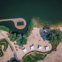
Przylasek Rusiecki
Z Placu Centralnego na Przylasek Rusiecki Szlakiem Bursztynowym Greenways
A cycling route starting in Kokotów, Lesser Poland Voivodeship, Poland.
Overview
About this route
The route follows the Greenways Amber Trail from the Central Square, through Żaglowa Street, Branicka Street, and Karaszewicza-Tokarzewskiego Street to the water bodies in Przylasek Rusiecki.
Due to the poor condition of the pavement on Jeżynowa Street, near the Kujawy Port, the route avoids the Bursztynowy Szlak Greenways on this section and turns onto the bike path on Igołomska Street.
- -:--
- Duration
- 14.3 km
- Distance
- 28 m
- Ascent
- 50 m
- Descent
- ---
- Avg. speed
- 216 m
- Max. altitude

Part of
3 stages
Route photos


Route quality
Waytypes & surfaces along the route
Waytypes
Quiet road
5.6 km
(39 %)
Road
3.4 km
(24 %)
Surfaces
Paved
12.3 km
(86 %)
Unpaved
1.4 km
(10 %)
Asphalt
10.7 km
(75 %)
Paved (undefined)
1.6 km
(11 %)
Route highlights
Points of interest along the route

Point of interest after 0 km
Plac Centralny

Photo after 10.1 km

Photo after 13.2 km
Continue with Bikemap
Use, edit, or download this cycling route
You would like to ride Z Placu Centralnego na Przylasek Rusiecki Szlakiem Bursztynowym Greenways or customize it for your own trip? Here is what you can do with this Bikemap route:
Free features
- Save this route as favorite or in collections
- Copy & plan your own version of this route
- Sync your route with Garmin or Wahoo
Premium features
Free trial for 3 days, or one-time payment. More about Bikemap Premium.
- Navigate this route on iOS & Android
- Export a GPX / KML file of this route
- Create your custom printout (try it for free)
- Download this route for offline navigation
Discover more Premium features.
Get Bikemap PremiumFrom our community
Other popular routes starting in Kokotów
 8 maja 2010 NCK - Zesławice - Raciborowice - al. Róż
- Distance
- 21.8 km
- Ascent
- 126 m
- Descent
- 121 m
- Location
- Kokotów, Lesser Poland Voivodeship, Poland
 Bulwarowa 43, Kraków do Osiedle Józefa Strusia 6, Kraków
- Distance
- 21.6 km
- Ascent
- 271 m
- Descent
- 236 m
- Location
- Kokotów, Lesser Poland Voivodeship, Poland
 Test Miejski Kellys Tnt 50 Orange
- Distance
- 35.4 km
- Ascent
- 82 m
- Descent
- 75 m
- Location
- Kokotów, Lesser Poland Voivodeship, Poland
 Mogiła-most kolejowy-Niepołomice-puszcza-Stanisławice
- Distance
- 33.4 km
- Ascent
- 83 m
- Descent
- 80 m
- Location
- Kokotów, Lesser Poland Voivodeship, Poland
 Z Placu Centralnego na Przylasek Rusiecki Szlakiem Bursztynowym Greenways
- Distance
- 14.3 km
- Ascent
- 28 m
- Descent
- 50 m
- Location
- Kokotów, Lesser Poland Voivodeship, Poland
 26 czerwca - współny odcinek trasy
- Distance
- 26.9 km
- Ascent
- 74 m
- Descent
- 64 m
- Location
- Kokotów, Lesser Poland Voivodeship, Poland
 Z Nowej Huty na Przylasek Rusiecki Wiślaną Trasą Rowerową
- Distance
- 25.4 km
- Ascent
- 8 m
- Descent
- 30 m
- Location
- Kokotów, Lesser Poland Voivodeship, Poland
 Kraków - Ojców
- Distance
- 72.5 km
- Ascent
- 915 m
- Descent
- 914 m
- Location
- Kokotów, Lesser Poland Voivodeship, Poland
Open it in the app