

Vosges deluxe #4
A cycling route starting in Soultzmatt, Grand Est, France.
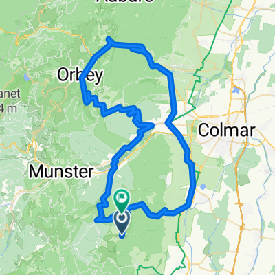
Overview
About this route
192km, 4123m elevation gain, 9h54/8h40
Col collecting route:
-
Col de Firstplan (722m), 485m elevation gain
-
Col de Wasserbourg (Cote 904m), 510m elevation gain
-
Collet du Linge (976m), 588m elevation gain
X. (Col du Wettstein, 880m, roll over)
- Col du Calvaire (1134m), 370m elevation gain
X. (Col du Louchpach (978m), roll over)
X. (Col du Bonhomme (949m), roll over)
X. Col des Bagnelles (905m), roll over to...
- Col du Pre de Raves (1005m), 320m elevation gain
X. Col de la Sebone
X. Col des Journaux
X. Col de Mandray
-
Col de Sarceneux (800m), 370m elevation gain
-
Col de la Schlucht (1139m), 450m elevation gain
-
Col de Platzewasel (1184m), 770m elevation gain
X. Le Breitfirst (1280m) continuation of 8
X. Le Markstein (1183m)
- Col de Bannstein (483m), 150m elevation gain
- -:--
- Duration
- 186.4 km
- Distance
- 3,752 m
- Ascent
- 3,752 m
- Descent
- ---
- Avg. speed
- ---
- Max. altitude

Route quality
Waytypes & surfaces along the route
Waytypes
Road
44.7 km
(24 %)
Quiet road
22.4 km
(12 %)
Surfaces
Paved
108.1 km
(58 %)
Unpaved
13 km
(7 %)
Asphalt
106.2 km
(57 %)
Unpaved (undefined)
5.6 km
(3 %)
Continue with Bikemap
Use, edit, or download this cycling route
You would like to ride Vosges deluxe #4 or customize it for your own trip? Here is what you can do with this Bikemap route:
Free features
- Save this route as favorite or in collections
- Copy & plan your own version of this route
- Split it into stages to create a multi-day tour
- Sync your route with Garmin or Wahoo
Premium features
Free trial for 3 days, or one-time payment. More about Bikemap Premium.
- Navigate this route on iOS & Android
- Export a GPX / KML file of this route
- Create your custom printout (try it for free)
- Download this route for offline navigation
Discover more Premium features.
Get Bikemap PremiumFrom our community
Other popular routes starting in Soultzmatt
 Rte des Crêtes 2013
- Distance
- 113.3 km
- Ascent
- 1,842 m
- Descent
- 1,842 m
- Location
- Soultzmatt, Grand Est, France
 quäldich.de - Vogesen, E1 - Auberge du Boenlesgrab
- Distance
- 44.4 km
- Ascent
- 721 m
- Descent
- 717 m
- Location
- Soultzmatt, Grand Est, France
 Route nach D40, 68570 Osenbach
- Distance
- 86.5 km
- Ascent
- 2,583 m
- Descent
- 2,445 m
- Location
- Soultzmatt, Grand Est, France
 westhal savern 116 620
- Distance
- 116.1 km
- Ascent
- 790 m
- Descent
- 902 m
- Location
- Soultzmatt, Grand Est, France
 Vosges deluxe
- Distance
- 194.1 km
- Ascent
- 3,585 m
- Descent
- 3,585 m
- Location
- Soultzmatt, Grand Est, France
 Alsace Ballons + 2
- Distance
- 156.6 km
- Ascent
- 3,213 m
- Descent
- 3,230 m
- Location
- Soultzmatt, Grand Est, France
 quälich.de - Vogesen, E1a - Klassiker zum Auftakt
- Distance
- 65.2 km
- Ascent
- 1,306 m
- Descent
- 1,306 m
- Location
- Soultzmatt, Grand Est, France
 Vogesen II CLONED FROM ROUTE 338990
- Distance
- 101.6 km
- Ascent
- 2,196 m
- Descent
- 2,197 m
- Location
- Soultzmatt, Grand Est, France
Open it in the app