

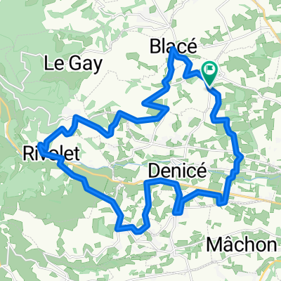
Cols du Beaujolais
A cycling route starting in Blacé, Auvergne-Rhône-Alpes, France.
Overview
About this route
- -:--
- Duration
- 83.2 km
- Distance
- 1,834 m
- Ascent
- 1,832 m
- Descent
- ---
- Avg. speed
- ---
- Max. altitude
Route quality
Waytypes & surfaces along the route
Waytypes
Road
27.5 km
(33 %)
Quiet road
16.6 km
(20 %)
Surfaces
Paved
10 km
(12 %)
Unpaved
1.7 km
(2 %)
Asphalt
10 km
(12 %)
Unpaved (undefined)
1.7 km
(2 %)
Undefined
71.5 km
(86 %)
Route highlights
Points of interest along the route
Point of interest after 9.1 km
Col de Pierre Plate 593m
Point of interest after 10.8 km
Col de la Croix Rosier 721m
Point of interest after 13 km
Col de la Croix Marchampt 687m
Point of interest after 24 km
Col de la Casse Froide 739m
Point of interest after 24.5 km
Col de la Croix de l'Allier 812m (R1)
Point of interest after 27 km
Mt Soubran
Point of interest after 42.6 km
Col de la Croix Nicelle
Point of interest after 44.6 km
Col de Favardy
Point of interest after 50.3 km
Col des Ecorbans
Point of interest after 52.6 km
Col des Aillets
Point of interest after 59.8 km
Col de la Croix des Brosses
Continue with Bikemap
Use, edit, or download this cycling route
You would like to ride Cols du Beaujolais or customize it for your own trip? Here is what you can do with this Bikemap route:
Free features
- Save this route as favorite or in collections
- Copy & plan your own version of this route
- Split it into stages to create a multi-day tour
- Sync your route with Garmin or Wahoo
Premium features
Free trial for 3 days, or one-time payment. More about Bikemap Premium.
- Navigate this route on iOS & Android
- Export a GPX / KML file of this route
- Create your custom printout (try it for free)
- Download this route for offline navigation
Discover more Premium features.
Get Bikemap PremiumFrom our community
Other popular routes starting in Blacé
 De D19, Salles-Arbuissonnas-en-Beaujolais à D19, Salles-Arbuissonnas-en-Beaujolais
- Distance
- 25.5 km
- Ascent
- 386 m
- Descent
- 455 m
- Location
- Blacé, Auvergne-Rhône-Alpes, France
 beaujolais 2013 cogny
- Distance
- 23.4 km
- Ascent
- 417 m
- Descent
- 420 m
- Location
- Blacé, Auvergne-Rhône-Alpes, France
 bruno chercher son fiol
- Distance
- 39.8 km
- Ascent
- 237 m
- Descent
- 229 m
- Location
- Blacé, Auvergne-Rhône-Alpes, France
 sur la crete
- Distance
- 13.8 km
- Ascent
- 396 m
- Descent
- 395 m
- Location
- Blacé, Auvergne-Rhône-Alpes, France
 sortie Bucoliques 23/05/21
- Distance
- 25.3 km
- Ascent
- 654 m
- Descent
- 645 m
- Location
- Blacé, Auvergne-Rhône-Alpes, France
 Beaujolais_Circuit_01
- Distance
- 28.4 km
- Ascent
- 564 m
- Descent
- 564 m
- Location
- Blacé, Auvergne-Rhône-Alpes, France
 De 774 Chemin des Côtes, Saint-Julien à 1–64 Rue de l'Église, Odenas
- Distance
- 8.5 km
- Ascent
- 480 m
- Descent
- 467 m
- Location
- Blacé, Auvergne-Rhône-Alpes, France
 B 2019 E 8 ter
- Distance
- 90.8 km
- Ascent
- 696 m
- Descent
- 629 m
- Location
- Blacé, Auvergne-Rhône-Alpes, France
Open it in the app