
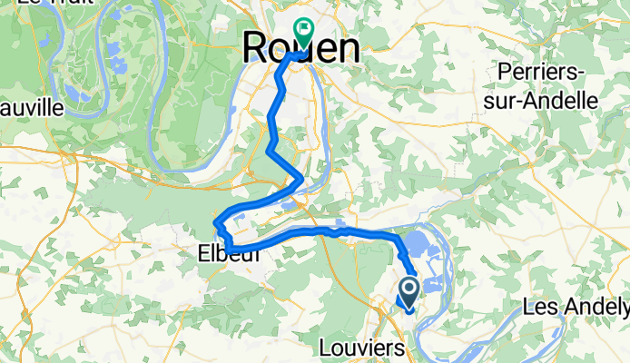
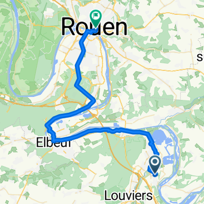
J4: St Etienne du Vauvray - Rouen
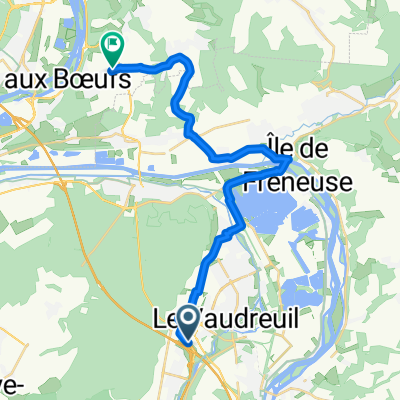
A cycling route starting in Le Vaudreuil, Normandy, France.
Overview
About this route
- -:--
- Duration
- 49 km
- Distance
- 147 m
- Ascent
- 138 m
- Descent
- ---
- Avg. speed
- 87 m
- Max. altitude
Route quality
Waytypes & surfaces along the route
Waytypes
Busy road
13.8 km
(28 %)
Quiet road
9.4 km
(19 %)
Surfaces
Paved
41.4 km
(85 %)
Asphalt
34 km
(69 %)
Paved (undefined)
7.1 km
(15 %)
Route highlights
Points of interest along the route
Point of interest after 27.4 km
Orival : sites des roches eglise semi trogloditique
Continue with Bikemap
Use, edit, or download this cycling route
You would like to ride J4: St Etienne du Vauvray - Rouen or customize it for your own trip? Here is what you can do with this Bikemap route:
Free features
- Save this route as favorite or in collections
- Copy & plan your own version of this route
- Sync your route with Garmin or Wahoo
Premium features
Free trial for 3 days, or one-time payment. More about Bikemap Premium.
- Navigate this route on iOS & Android
- Export a GPX / KML file of this route
- Create your custom printout (try it for free)
- Download this route for offline navigation
Discover more Premium features.
Get Bikemap PremiumFrom our community
Other popular routes starting in Le Vaudreuil
 Val de Reuil - Chatillon 160 km
- Distance
- 154.2 km
- Ascent
- 658 m
- Descent
- 548 m
- Location
- Le Vaudreuil, Normandy, France
 D 6015, Le Vaudreuil to Route de Chambray, Saint-Marcel
- Distance
- 32.2 km
- Ascent
- 302 m
- Descent
- 261 m
- Location
- Le Vaudreuil, Normandy, France
 Retour Le Vaudreuil St Aubin
- Distance
- 26.4 km
- Ascent
- 159 m
- Descent
- 35 m
- Location
- Le Vaudreuil, Normandy, France
 123 Rue Bernard Chédeville, Le Vaudreuil to Rue Gilles Nicolle, Les Andelys
- Distance
- 24.9 km
- Ascent
- 31 m
- Descent
- 29 m
- Location
- Le Vaudreuil, Normandy, France
 Itinéraire modéré en Le Vaudreuil
- Distance
- 13.3 km
- Ascent
- 22 m
- Descent
- 27 m
- Location
- Le Vaudreuil, Normandy, France
 Louviers - La Ferte-Bernard
- Distance
- 151.9 km
- Ascent
- 445 m
- Descent
- 309 m
- Location
- Le Vaudreuil, Normandy, France
 Convergence A28 A13 3
- Distance
- 22.4 km
- Ascent
- 163 m
- Descent
- 98 m
- Location
- Le Vaudreuil, Normandy, France
 J4: St Etienne du Vauvray - Rouen
- Distance
- 49 km
- Ascent
- 147 m
- Descent
- 138 m
- Location
- Le Vaudreuil, Normandy, France
Open it in the app