

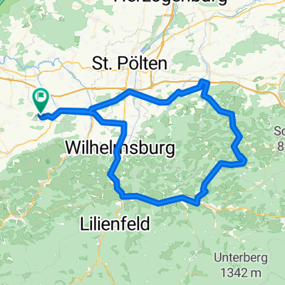
Scheibbser Runde
A cycling route starting in Sankt Margarethen an der Sierning, Lower Austria, Austria.
Overview
About this route
- -:--
- Duration
- 107.5 km
- Distance
- 962 m
- Ascent
- 962 m
- Descent
- ---
- Avg. speed
- ---
- Max. altitude
Route quality
Waytypes & surfaces along the route
Waytypes
Road
8.6 km
(8 %)
Quiet road
6.4 km
(6 %)
Surfaces
Paved
66.6 km
(62 %)
Asphalt
63.4 km
(59 %)
Paved (undefined)
3.2 km
(3 %)
Undefined
40.8 km
(38 %)
Route highlights
Points of interest along the route
Point of interest after 107.5 km
Home sweet Home
Continue with Bikemap
Use, edit, or download this cycling route
You would like to ride Scheibbser Runde or customize it for your own trip? Here is what you can do with this Bikemap route:
Free features
- Save this route as favorite or in collections
- Copy & plan your own version of this route
- Split it into stages to create a multi-day tour
- Sync your route with Garmin or Wahoo
Premium features
Free trial for 3 days, or one-time payment. More about Bikemap Premium.
- Navigate this route on iOS & Android
- Export a GPX / KML file of this route
- Create your custom printout (try it for free)
- Download this route for offline navigation
Discover more Premium features.
Get Bikemap PremiumFrom our community
Other popular routes starting in Sankt Margarethen an der Sierning
 Seiberer Jauerling
- Distance
- 96.7 km
- Ascent
- 1,467 m
- Descent
- 1,470 m
- Location
- Sankt Margarethen an der Sierning, Lower Austria, Austria
 Linsberg 29, St. Margarethen nach Kreuzfeldgasse 4, Pyhra
- Distance
- 37.4 km
- Ascent
- 246 m
- Descent
- 209 m
- Location
- Sankt Margarethen an der Sierning, Lower Austria, Austria
 Linsberg 29, St. Margarethen nach Babenbergerstraße 7, Melk
- Distance
- 17.9 km
- Ascent
- 76 m
- Descent
- 116 m
- Location
- Sankt Margarethen an der Sierning, Lower Austria, Austria
 Tag 1 St.Margarethen - Walding
- Distance
- 131.9 km
- Ascent
- 92 m
- Descent
- 77 m
- Location
- Sankt Margarethen an der Sierning, Lower Austria, Austria
 Nizza 1
- Distance
- 186.2 km
- Ascent
- 323 m
- Descent
- 205 m
- Location
- Sankt Margarethen an der Sierning, Lower Austria, Austria
 Radausfahrt am 10.05.2011
- Distance
- 85.1 km
- Ascent
- 623 m
- Descent
- 625 m
- Location
- Sankt Margarethen an der Sierning, Lower Austria, Austria
 Scheibbser Runde
- Distance
- 107.5 km
- Ascent
- 962 m
- Descent
- 962 m
- Location
- Sankt Margarethen an der Sierning, Lower Austria, Austria
 Linsberg 29, St. Margarethen nach Linzer Straße 53, Prinzersdorf
- Distance
- 52.5 km
- Ascent
- 809 m
- Descent
- 823 m
- Location
- Sankt Margarethen an der Sierning, Lower Austria, Austria
Open it in the app