

Ennsradweg: Radstadt - Amstetten (2021)
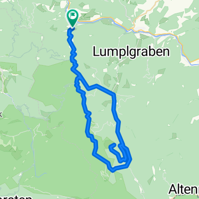
Reichraming - Enns
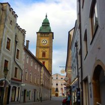
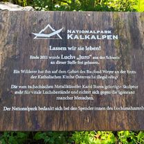
A cycling route starting in Reichraming, Upper Austria, Austria.
Overview
About this route
Ennsradweg: Radstadt - Amstetten, Tag 4/5
Routensammlung Ennsradweg: Radstadt - Amstetten
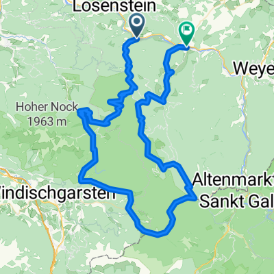
Tag 3: Hieflau - Reichraming
Tag 5: Enns - Amstetten
- -:--
- Duration
- 63.8 km
- Distance
- 238 m
- Ascent
- 342 m
- Descent
- ---
- Avg. speed
- 392 m
- Max. altitude

Part of
Route quality
Waytypes & surfaces along the route
Waytypes
Quiet road
33.8 km
(53 %)
Road
15.3 km
(24 %)
Surfaces
Paved
30.6 km
(48 %)
Unpaved
3.8 km
(6 %)
Asphalt
30 km
(47 %)
Gravel
1.9 km
(3 %)
Continue with Bikemap
Use, edit, or download this cycling route
You would like to ride Reichraming - Enns or customize it for your own trip? Here is what you can do with this Bikemap route:
Free features
- Save this route as favorite or in collections
- Copy & plan your own version of this route
- Sync your route with Garmin or Wahoo
Premium features
Free trial for 3 days, or one-time payment. More about Bikemap Premium.
- Navigate this route on iOS & Android
- Export a GPX / KML file of this route
- Create your custom printout (try it for free)
- Download this route for offline navigation
Discover more Premium features.
Get Bikemap PremiumFrom our community
Other popular routes starting in Reichraming
 Hintergebirgsradweg R9 Reichraming
- Distance
- 45.5 km
- Ascent
- 640 m
- Descent
- 664 m
- Location
- Reichraming, Upper Austria, Austria
 Anlaufalm
- Distance
- 53.5 km
- Ascent
- 871 m
- Descent
- 875 m
- Location
- Reichraming, Upper Austria, Austria
 R9 Hintergebirgsradweg Anlaufalm
- Distance
- 54.1 km
- Ascent
- 903 m
- Descent
- 911 m
- Location
- Reichraming, Upper Austria, Austria
 Molln /Schaunbergalm / Ebenforstalm
- Distance
- 33.1 km
- Ascent
- 1,034 m
- Descent
- 1,032 m
- Location
- Reichraming, Upper Austria, Austria
 Breitenau, Ebenforstalm, Breitenau
- Distance
- 24.2 km
- Ascent
- 690 m
- Descent
- 683 m
- Location
- Reichraming, Upper Austria, Austria
 Rakousko 2012-4.den-17.7.Út
- Distance
- 42.2 km
- Ascent
- 686 m
- Descent
- 594 m
- Location
- Reichraming, Upper Austria, Austria
 Reichraming Ramble
- Distance
- 95.2 km
- Ascent
- 3,869 m
- Descent
- 3,842 m
- Location
- Reichraming, Upper Austria, Austria
 Hintergebirgsrunde
- Distance
- 36.1 km
- Ascent
- 1,059 m
- Descent
- 1,055 m
- Location
- Reichraming, Upper Austria, Austria
Open it in the app