

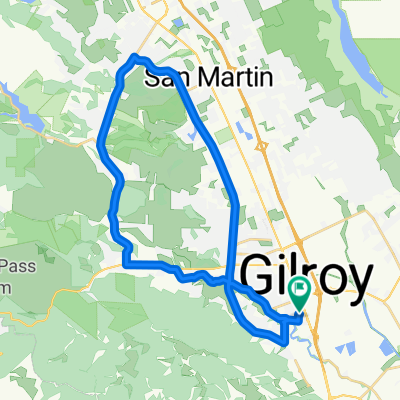
Gilroy Cycling
A cycling route starting in Gilroy, California, United States.
Overview
About this route
EDGE 520 PLUS®
- -:--
- Duration
- 101.5 km
- Distance
- 768 m
- Ascent
- 761 m
- Descent
- ---
- Avg. speed
- 340 m
- Max. altitude

Route quality
Waytypes & surfaces along the route
Waytypes
Quiet road
32.5 km
(32 %)
Road
27.4 km
(27 %)
Surfaces
Paved
46.7 km
(46 %)
Asphalt
46.7 km
(46 %)
Undefined
54.8 km
(54 %)
Continue with Bikemap
Use, edit, or download this cycling route
You would like to ride Gilroy Cycling or customize it for your own trip? Here is what you can do with this Bikemap route:
Free features
- Save this route as favorite or in collections
- Copy & plan your own version of this route
- Split it into stages to create a multi-day tour
- Sync your route with Garmin or Wahoo
Premium features
Free trial for 3 days, or one-time payment. More about Bikemap Premium.
- Navigate this route on iOS & Android
- Export a GPX / KML file of this route
- Create your custom printout (try it for free)
- Download this route for offline navigation
Discover more Premium features.
Get Bikemap PremiumFrom our community
Other popular routes starting in Gilroy
 Long Morning Track In Gilroy
- Distance
- 20.8 km
- Ascent
- 20 m
- Descent
- 20 m
- Location
- Gilroy, California, United States
 Roop to Canada
- Distance
- 32.1 km
- Ascent
- 625 m
- Descent
- 611 m
- Location
- Gilroy, California, United States
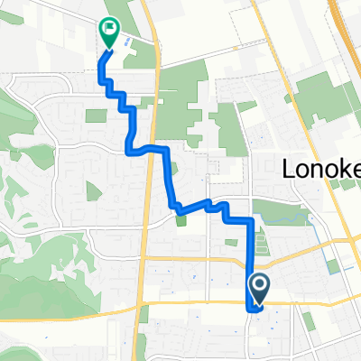
 Day Rd W, Gilroy to First St, Gilroy
- Distance
- 4.7 km
- Ascent
- 7 m
- Descent
- 10 m
- Location
- Gilroy, California, United States
 Relaxed Wednesday Ride In Gilroy
- Distance
- 33.9 km
- Ascent
- 128 m
- Descent
- 128 m
- Location
- Gilroy, California, United States
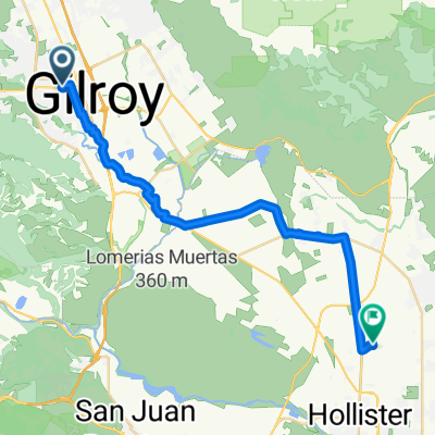 First St, Gilroy to Shelton Dr, Hollister
- Distance
- 29.9 km
- Ascent
- 44 m
- Descent
- 40 m
- Location
- Gilroy, California, United States
 758 Gettysburg Way, Gilroy to 765 Gettysburg Way, Gilroy
- Distance
- 9.4 km
- Ascent
- 27 m
- Descent
- 25 m
- Location
- Gilroy, California, United States
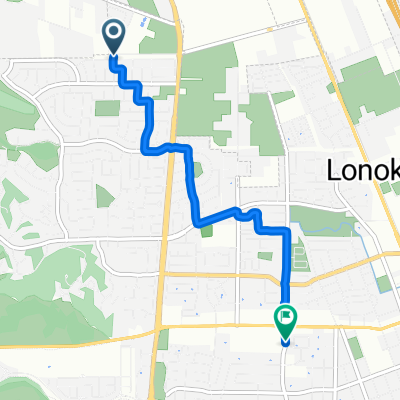
 First St, Gilroy to Day Rd W, Gilroy
- Distance
- 4.9 km
- Ascent
- 13 m
- Descent
- 6 m
- Location
- Gilroy, California, United States
 Watsonville rd
- Distance
- 36.6 km
- Ascent
- 152 m
- Descent
- 152 m
- Location
- Gilroy, California, United States
Open it in the app