

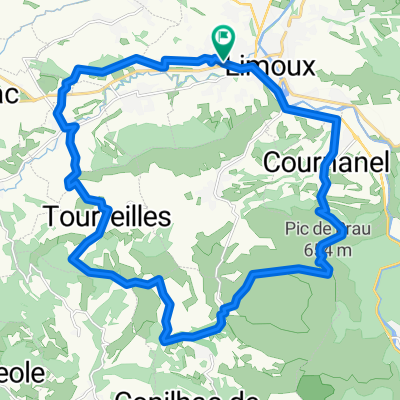
S-14. Limoux - Albi (136,3 Km)
A cycling route starting in Limoux, Occitanie, France.
Overview
About this route
- -:--
- Duration
- 136.3 km
- Distance
- 1,120 m
- Ascent
- 1,113 m
- Descent
- ---
- Avg. speed
- 325 m
- Max. altitude
Route quality
Waytypes & surfaces along the route
Waytypes
Road
25.9 km
(19 %)
Quiet road
20.4 km
(15 %)
Surfaces
Paved
40.9 km
(30 %)
Unpaved
8.2 km
(6 %)
Asphalt
40.9 km
(30 %)
Loose gravel
5.5 km
(4 %)
Route highlights
Points of interest along the route
Point of interest after 55 km
Côte de PECH LAOUGER (3) Km 55 · 306 m
Point of interest after 95.2 km
Sprint CASTRES Km. 94
Point of interest after 109.6 km
Côte de CANTEGREL (3) 108,5 Km · 325 m
Continue with Bikemap
Use, edit, or download this cycling route
You would like to ride S-14. Limoux - Albi (136,3 Km) or customize it for your own trip? Here is what you can do with this Bikemap route:
Free features
- Save this route as favorite or in collections
- Copy & plan your own version of this route
- Split it into stages to create a multi-day tour
- Sync your route with Garmin or Wahoo
Premium features
Free trial for 3 days, or one-time payment. More about Bikemap Premium.
- Navigate this route on iOS & Android
- Export a GPX / KML file of this route
- Create your custom printout (try it for free)
- Download this route for offline navigation
Discover more Premium features.
Get Bikemap PremiumFrom our community
Other popular routes starting in Limoux
 S-14. Limoux - Albi (136,3 Km)
- Distance
- 136.3 km
- Ascent
- 1,120 m
- Descent
- 1,113 m
- Location
- Limoux, Occitanie, France
 Boucle cyclo Limoux - Saint-Salvayre
- Distance
- 58 km
- Ascent
- 840 m
- Descent
- 840 m
- Location
- Limoux, Occitanie, France
 Stage 14 Tour de France 2012 - Limoux to Foix
- Distance
- 193.1 km
- Ascent
- 2,489 m
- Descent
- 2,257 m
- Location
- Limoux, Occitanie, France
 laGrasse
- Distance
- 106.8 km
- Ascent
- 870 m
- Descent
- 870 m
- Location
- Limoux, Occitanie, France
 Tour de France - Etappe 15
- Distance
- 188.8 km
- Ascent
- 566 m
- Descent
- 699 m
- Location
- Limoux, Occitanie, France
 Boucle route Limoux
- Distance
- 117 km
- Ascent
- 1,311 m
- Descent
- 1,311 m
- Location
- Limoux, Occitanie, France
 Limoux - Foix 68km 510u,300d,4h30
- Distance
- 67.9 km
- Ascent
- 502 m
- Descent
- 295 m
- Location
- Limoux, Occitanie, France
 Croix Saint-Pierre / Pic de Brau
- Distance
- 27.8 km
- Ascent
- 891 m
- Descent
- 891 m
- Location
- Limoux, Occitanie, France
Open it in the app