

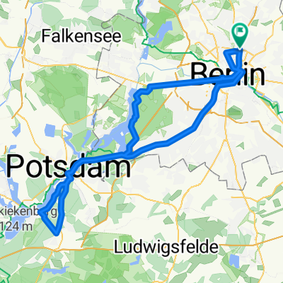
Berlin-Hennigsdorf-Falkensee-Potsdam-Berlin
A cycling route starting in Gesundbrunnen, State of Berlin, Germany.
Overview
About this route
Im Westen raus aus Berlin nach Norden, südlich übers Land nach Potsdam, zurück nach Wannsee, auf die Havelchaussee und durch die Stadt zurück.
- -:--
- Duration
- 99.2 km
- Distance
- 280 m
- Ascent
- 286 m
- Descent
- ---
- Avg. speed
- 86 m
- Max. altitude

Route quality
Waytypes & surfaces along the route
Waytypes
Busy road
37.9 km
(38 %)
Cycleway
19.4 km
(20 %)
Surfaces
Paved
92.1 km
(93 %)
Unpaved
1 km
(1 %)
Asphalt
75.3 km
(76 %)
Paving stones
16.1 km
(16 %)
Continue with Bikemap
Use, edit, or download this cycling route
You would like to ride Berlin-Hennigsdorf-Falkensee-Potsdam-Berlin or customize it for your own trip? Here is what you can do with this Bikemap route:
Free features
- Save this route as favorite or in collections
- Copy & plan your own version of this route
- Split it into stages to create a multi-day tour
- Sync your route with Garmin or Wahoo
Premium features
Free trial for 3 days, or one-time payment. More about Bikemap Premium.
- Navigate this route on iOS & Android
- Export a GPX / KML file of this route
- Create your custom printout (try it for free)
- Download this route for offline navigation
Discover more Premium features.
Get Bikemap PremiumFrom our community
Other popular routes starting in Gesundbrunnen
 Prenzlauer Berg, Mühlenbeck, Blankenfelde
- Distance
- 33.8 km
- Ascent
- 44 m
- Descent
- 46 m
- Location
- Gesundbrunnen, State of Berlin, Germany
![[45km] Wedding-Schönerlinde-Basdorf-Mühlenbeck-Wedding](https://media.bikemap.net/routes/2272514/staticmaps/in_2477869c-b609-427b-9e20-7cb285ac7bb1_400x400_bikemap-2021-3D-static.png) [45km] Wedding-Schönerlinde-Basdorf-Mühlenbeck-Wedding
[45km] Wedding-Schönerlinde-Basdorf-Mühlenbeck-Wedding- Distance
- 45.7 km
- Ascent
- 85 m
- Descent
- 85 m
- Location
- Gesundbrunnen, State of Berlin, Germany
 12 Strausberg Märkische Schweiz
- Distance
- 55.5 km
- Ascent
- 83 m
- Descent
- 83 m
- Location
- Gesundbrunnen, State of Berlin, Germany
 Berliner Mauerweg Nordroute
- Distance
- 48.5 km
- Ascent
- 123 m
- Descent
- 137 m
- Location
- Gesundbrunnen, State of Berlin, Germany
 Feierabendrunde für den Norden
- Distance
- 67.1 km
- Ascent
- 61 m
- Descent
- 56 m
- Location
- Gesundbrunnen, State of Berlin, Germany
 Mauerpark > Plötzensee > Jungfernheide > HauptBhf. > Invaliedenfriedhof
- Distance
- 23.6 km
- Ascent
- 51 m
- Descent
- 50 m
- Location
- Gesundbrunnen, State of Berlin, Germany
 Die Eberswalde Extension 2
- Distance
- 119.3 km
- Ascent
- 342 m
- Descent
- 342 m
- Location
- Gesundbrunnen, State of Berlin, Germany
 Raus aus Berlin, anschlagen und zurück
- Distance
- 96.3 km
- Ascent
- 393 m
- Descent
- 403 m
- Location
- Gesundbrunnen, State of Berlin, Germany
Open it in the app