

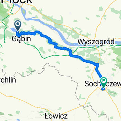
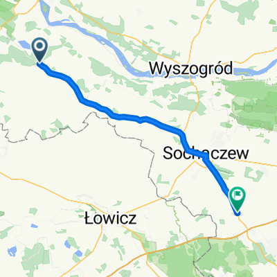
I Rajd Szlakiem Znaczka Turystycznego - Gąbin 2021-07-17
A cycling route starting in Gąbin, Masovian Voivodeship, Poland.
Overview
About this route
Visited:
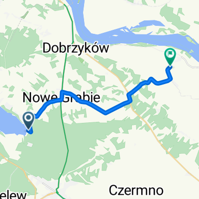
Wooden churches in Dobrzyków and Troszyn.
At the cemetery in Dobrzyków, the monument to the January insurgents and the graves of soldiers who fell in 1939.
Museum of the Gąbin Land in Gąbin.
- -:--
- Duration
- 33.7 km
- Distance
- 107 m
- Ascent
- 109 m
- Descent
- ---
- Avg. speed
- 108 m
- Max. altitude

Route quality
Waytypes & surfaces along the route
Waytypes
Quiet road
16.9 km
(50 %)
Road
11.8 km
(35 %)
Surfaces
Paved
24.6 km
(73 %)
Asphalt
24.6 km
(73 %)
Undefined
9.1 km
(27 %)
Continue with Bikemap
Use, edit, or download this cycling route
You would like to ride I Rajd Szlakiem Znaczka Turystycznego - Gąbin 2021-07-17 or customize it for your own trip? Here is what you can do with this Bikemap route:
Free features
- Save this route as favorite or in collections
- Copy & plan your own version of this route
- Sync your route with Garmin or Wahoo
Premium features
Free trial for 3 days, or one-time payment. More about Bikemap Premium.
- Navigate this route on iOS & Android
- Export a GPX / KML file of this route
- Create your custom printout (try it for free)
- Download this route for offline navigation
Discover more Premium features.
Get Bikemap PremiumFrom our community
Other popular routes starting in Gąbin
 Trasa relaksacyjna
- Distance
- 19 km
- Ascent
- 60 m
- Descent
- 65 m
- Location
- Gąbin, Masovian Voivodeship, Poland
 I Rajd Szlakiem Znaczka Turystycznego - Gąbin 2021-07-17
- Distance
- 33.7 km
- Ascent
- 107 m
- Descent
- 109 m
- Location
- Gąbin, Masovian Voivodeship, Poland
 Do Płocka i z powrotem
- Distance
- 39.6 km
- Ascent
- 149 m
- Descent
- 150 m
- Location
- Gąbin, Masovian Voivodeship, Poland
 Dzień 2 v2
- Distance
- 61.5 km
- Ascent
- 100 m
- Descent
- 89 m
- Location
- Gąbin, Masovian Voivodeship, Poland
 2013/07 - Gąbin
- Distance
- 14 km
- Ascent
- 82 m
- Descent
- 77 m
- Location
- Gąbin, Masovian Voivodeship, Poland
 Las Gąbiński 2
- Distance
- 6.4 km
- Ascent
- 37 m
- Descent
- 40 m
- Location
- Gąbin, Masovian Voivodeship, Poland
 Jeziorna, Łąck do Nowy Troszyn, Gąbin
- Distance
- 12 km
- Ascent
- 58 m
- Descent
- 76 m
- Location
- Gąbin, Masovian Voivodeship, Poland
 Gąbin - Guzów
- Distance
- 56.5 km
- Ascent
- 65 m
- Descent
- 69 m
- Location
- Gąbin, Masovian Voivodeship, Poland
Open it in the app