

LA QUEBRANTAHUESOS DEL SUR
A cycling route starting in Aguadulce, Andalusia, Spain.
Overview
About this route
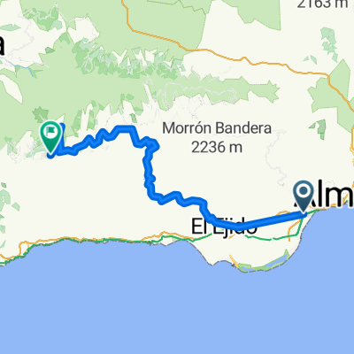
THE SOUTHERN QUEBRANTAHUESOS.
A tough road cycling route that covers no less than 200 km across much of the province of Almería. Starting near the sea, it ascends several mountain passes, including Calar Alto which rises to 2150 meters above sea level. The return to the starting point passes through contrasting landscapes: the deserts of Tabernas, the low valley plains of the Andarax, and the entire coastal frontage from the town of Costacabana to El Parador de las Hortichuelas, including the crossing of the city of Almería. The difficulty from the distance is compounded by the accumulated elevation gain of several mountain passes and the distinctive characteristics of an arid climate such as that of the southeastern Iberian Peninsula.
- -:--
- Duration
- 200 km
- Distance
- 3,174 m
- Ascent
- 3,176 m
- Descent
- ---
- Avg. speed
- ---
- Max. altitude
Route quality
Waytypes & surfaces along the route
Waytypes
Road
100 km
(50 %)
Cycleway
18 km
(9 %)
Surfaces
Paved
68 km
(34 %)
Unpaved
18 km
(9 %)
Asphalt
68 km
(34 %)
Gravel
14 km
(7 %)
Continue with Bikemap
Use, edit, or download this cycling route
You would like to ride LA QUEBRANTAHUESOS DEL SUR or customize it for your own trip? Here is what you can do with this Bikemap route:
Free features
- Save this route as favorite or in collections
- Copy & plan your own version of this route
- Split it into stages to create a multi-day tour
- Sync your route with Garmin or Wahoo
Premium features
Free trial for 3 days, or one-time payment. More about Bikemap Premium.
- Navigate this route on iOS & Android
- Export a GPX / KML file of this route
- Create your custom printout (try it for free)
- Download this route for offline navigation
Discover more Premium features.
Get Bikemap PremiumFrom our community
Other popular routes starting in Aguadulce
 Parador-Berja-Berchules-Trevelz-Busquístar
- Distance
- 124.1 km
- Ascent
- 4,524 m
- Descent
- 3,409 m
- Location
- Aguadulce, Andalusia, Spain
 AGUADULCE-FELIX-Peñón de BERNAL
- Distance
- 38.8 km
- Ascent
- 909 m
- Descent
- 907 m
- Location
- Aguadulce, Andalusia, Spain
 Aguadulce-Casa
- Distance
- 101 km
- Ascent
- 1,272 m
- Descent
- 878 m
- Location
- Aguadulce, Andalusia, Spain
 GRAN RUTA Roquetas-Alpujarra
- Distance
- 133 km
- Ascent
- 2,240 m
- Descent
- 2,242 m
- Location
- Aguadulce, Andalusia, Spain
 G.R. Día de Andalucía 2014
- Distance
- 150.7 km
- Ascent
- 3,017 m
- Descent
- 3,012 m
- Location
- Aguadulce, Andalusia, Spain
 NOCTURNA: TARTEL-FELIX-PERROS
- Distance
- 59.3 km
- Ascent
- 1,366 m
- Descent
- 1,363 m
- Location
- Aguadulce, Andalusia, Spain
 LA QUEBRANTAHUESOS DEL SUR
- Distance
- 200 km
- Ascent
- 3,174 m
- Descent
- 3,176 m
- Location
- Aguadulce, Andalusia, Spain
 2ª QDD BTT EL PARADOR
- Distance
- 31.2 km
- Ascent
- 812 m
- Descent
- 812 m
- Location
- Aguadulce, Andalusia, Spain
Open it in the app