

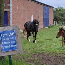
D - Recklinghausen - Rund um Recklinghausen (WAZ 10) - 43 km
A cycling route starting in Recklinghausen, North Rhine-Westphalia, Germany.
Overview
About this route
Cycling tour through the Ruhr area from the WAZ 'Ruhrgebiet - Biking and discovering!'.
- -:--
- Duration
- 42.5 km
- Distance
- 193 m
- Ascent
- 193 m
- Descent
- ---
- Avg. speed
- ---
- Max. altitude

Route quality
Waytypes & surfaces along the route
Waytypes
Quiet road
17 km
(40 %)
Path
9.8 km
(23 %)
Surfaces
Paved
20.8 km
(49 %)
Unpaved
9.8 km
(23 %)
Asphalt
17.9 km
(42 %)
Loose gravel
6.4 km
(15 %)
Continue with Bikemap
Use, edit, or download this cycling route
You would like to ride D - Recklinghausen - Rund um Recklinghausen (WAZ 10) - 43 km or customize it for your own trip? Here is what you can do with this Bikemap route:
Free features
- Save this route as favorite or in collections
- Copy & plan your own version of this route
- Sync your route with Garmin or Wahoo
Premium features
Free trial for 3 days, or one-time payment. More about Bikemap Premium.
- Navigate this route on iOS & Android
- Export a GPX / KML file of this route
- Create your custom printout (try it for free)
- Download this route for offline navigation
Discover more Premium features.
Get Bikemap PremiumFrom our community
Other popular routes starting in Recklinghausen
 Recklinghausen Runde
- Distance
- 38.7 km
- Ascent
- 205 m
- Descent
- 202 m
- Location
- Recklinghausen, North Rhine-Westphalia, Germany
 Halterner Straße 16, Marl nach Halterner Straße 16, Marl
- Distance
- 30.2 km
- Ascent
- 328 m
- Descent
- 327 m
- Location
- Recklinghausen, North Rhine-Westphalia, Germany
 Buchi's Runde
- Distance
- 58.8 km
- Ascent
- 321 m
- Descent
- 314 m
- Location
- Recklinghausen, North Rhine-Westphalia, Germany
 RE-Haardt-Flaesheim-TÜP Reken-RE 54km
- Distance
- 54.9 km
- Ascent
- 338 m
- Descent
- 337 m
- Location
- Recklinghausen, North Rhine-Westphalia, Germany
 13.05.2008 - 20:02
- Distance
- 23.8 km
- Ascent
- 61 m
- Descent
- 61 m
- Location
- Recklinghausen, North Rhine-Westphalia, Germany
 In den Heuwiesen 34, Recklinghausen nach Blitzkuhlenstraße 123, Recklinghausen
- Distance
- 34.8 km
- Ascent
- 145 m
- Descent
- 159 m
- Location
- Recklinghausen, North Rhine-Westphalia, Germany
 Von RE zum Rundkurs Unser-Fritz Ruhr nach Essen
- Distance
- 70.3 km
- Ascent
- 252 m
- Descent
- 249 m
- Location
- Recklinghausen, North Rhine-Westphalia, Germany
 RE- 38 km - Recklinghausen und Herten Rundkurs
- Distance
- 38.6 km
- Ascent
- 149 m
- Descent
- 149 m
- Location
- Recklinghausen, North Rhine-Westphalia, Germany
Open it in the app