

Traversée des Alpes
4. Briançon - col de la Cayolle
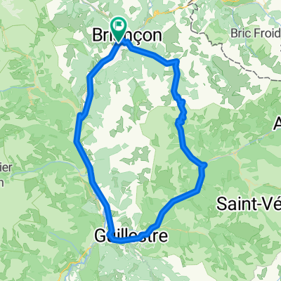
A cycling route starting in Briançon, Provence-Alpes-Côte d'Azur Region, France.
Overview
About this route
col de l'Izoard, col de Vars, col de la Cayolle
3760 D+
- -:--
- Duration
- 137.7 km
- Distance
- 3,274 m
- Ascent
- 2,699 m
- Descent
- ---
- Avg. speed
- 2,275 m
- Max. altitude
Part of
Traversée des Alpes
1 stage
Route quality
Waytypes & surfaces along the route
Waytypes
Quiet road
5.5 km
(4 %)
Undefined
132.2 km
(96 %)
Surfaces
Paved
100.5 km
(73 %)
Asphalt
100.5 km
(73 %)
Undefined
37.2 km
(27 %)
Continue with Bikemap
Use, edit, or download this cycling route
You would like to ride 4. Briançon - col de la Cayolle or customize it for your own trip? Here is what you can do with this Bikemap route:
Free features
- Save this route as favorite or in collections
- Copy & plan your own version of this route
- Split it into stages to create a multi-day tour
- Sync your route with Garmin or Wahoo
Premium features
Free trial for 3 days, or one-time payment. More about Bikemap Premium.
- Navigate this route on iOS & Android
- Export a GPX / KML file of this route
- Create your custom printout (try it for free)
- Download this route for offline navigation
Discover more Premium features.
Get Bikemap PremiumFrom our community
Other popular routes starting in Briançon
 5-Tag_Briancon-Saluzzo
- Distance
- 125.3 km
- Ascent
- 2,490 m
- Descent
- 3,355 m
- Location
- Briançon, Provence-Alpes-Côte d'Azur Region, France
 Colle dell Izoard
- Distance
- 84.5 km
- Ascent
- 1,581 m
- Descent
- 1,579 m
- Location
- Briançon, Provence-Alpes-Côte d'Azur Region, France
 Col de Granon
- Distance
- 49.5 km
- Ascent
- 1,442 m
- Descent
- 1,442 m
- Location
- Briançon, Provence-Alpes-Côte d'Azur Region, France
 briancon-izoard
- Distance
- 20.4 km
- Ascent
- 1,201 m
- Descent
- 155 m
- Location
- Briançon, Provence-Alpes-Côte d'Azur Region, France
 3 Briancon Izoard - Montgenevre - Sestriere -Montgenevre
- Distance
- 101 km
- Ascent
- 2,824 m
- Descent
- 2,787 m
- Location
- Briançon, Provence-Alpes-Côte d'Azur Region, France
 p27 Col du Lautaret
- Distance
- 54 km
- Ascent
- 867 m
- Descent
- 1,190 m
- Location
- Briançon, Provence-Alpes-Côte d'Azur Region, France
 Westalpen Etappe 09 - Briancon
- Distance
- 83.5 km
- Ascent
- 1,633 m
- Descent
- 1,633 m
- Location
- Briançon, Provence-Alpes-Côte d'Azur Region, France
![Briançon [Col d'Izoard] loop](https://media.bikemap.net/routes/4330868/staticmaps/in_dc7e89bc-1ec1-4a7f-a59e-af212601d962_400x400_bikemap-2021-3D-static.png) Briançon [Col d'Izoard] loop
Briançon [Col d'Izoard] loop- Distance
- 94.2 km
- Ascent
- 1,814 m
- Descent
- 1,814 m
- Location
- Briançon, Provence-Alpes-Côte d'Azur Region, France
Open it in the app