

미호동 1−5 to 성산면, 군산시
A cycling route starting in Sintansin, Daejeon, South Korea.
Overview
About this route
- 8 h 20 min
- Duration
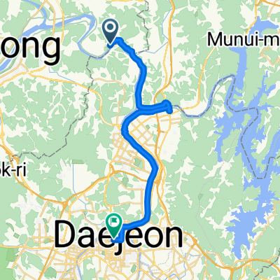
- 144.8 km
- Distance
- 127 m
- Ascent
- 207 m
- Descent
- 17.4 km/h
- Avg. speed
- 84 m
- Max. altitude

Route quality
Waytypes & surfaces along the route
Waytypes
Cycleway
111.5 km
(77 %)
Quiet road
10.1 km
(7 %)
Surfaces
Paved
75.3 km
(52 %)
Concrete
47.8 km
(33 %)
Asphalt
23.2 km
(16 %)
Continue with Bikemap
Use, edit, or download this cycling route
You would like to ride 미호동 1−5 to 성산면, 군산시 or customize it for your own trip? Here is what you can do with this Bikemap route:
Free features
- Save this route as favorite or in collections
- Copy & plan your own version of this route
- Split it into stages to create a multi-day tour
- Sync your route with Garmin or Wahoo
Premium features
Free trial for 3 days, or one-time payment. More about Bikemap Premium.
- Navigate this route on iOS & Android
- Export a GPX / KML file of this route
- Create your custom printout (try it for free)
- Download this route for offline navigation
Discover more Premium features.
Get Bikemap PremiumFrom our community
Other popular routes starting in Sintansin
 미호동 1−5 to 성산면, 군산시
- Distance
- 144.8 km
- Ascent
- 127 m
- Descent
- 207 m
- Location
- Sintansin, Daejeon, South Korea
 대청호 한바퀴
- Distance
- 82 km
- Ascent
- 1,265 m
- Descent
- 1,335 m
- Location
- Sintansin, Daejeon, South Korea
 Daecheongho
- Distance
- 79.3 km
- Ascent
- 821 m
- Descent
- 834 m
- Location
- Sintansin, Daejeon, South Korea
 Saejong_Chungju_Shintanjin
- Distance
- 88.1 km
- Ascent
- 235 m
- Descent
- 236 m
- Location
- Sintansin, Daejeon, South Korea
 안골 - 와동싱글 - 어은동
- Distance
- 24.8 km
- Ascent
- 315 m
- Descent
- 294 m
- Location
- Sintansin, Daejeon, South Korea
 금호리, 세종특별자치시에서 둔산대로, 대전광역시까지
- Distance
- 27 km
- Ascent
- 121 m
- Descent
- 112 m
- Location
- Sintansin, Daejeon, South Korea
 Geumgang
- Distance
- 148.4 km
- Ascent
- 196 m
- Descent
- 290 m
- Location
- Sintansin, Daejeon, South Korea
 Chudong_Daejeongni_Chusori
- Distance
- 81.5 km
- Ascent
- 996 m
- Descent
- 996 m
- Location
- Sintansin, Daejeon, South Korea
Open it in the app