

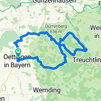
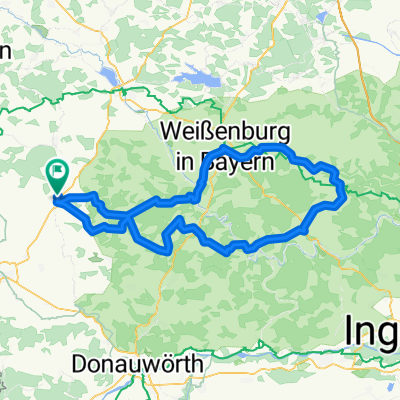
Oettingen Titting Oettingen
A cycling route starting in Hainsfarth, Bavaria, Germany.
Overview
About this route
Über Solnhofen nach Titting und über Weissenburg Treuchtlingen zurück.
- -:--
- Duration
- 135.3 km
- Distance
- 933 m
- Ascent
- 931 m
- Descent
- ---
- Avg. speed
- ---
- Max. altitude
Route quality
Waytypes & surfaces along the route
Waytypes
Busy road
61 km
(45 %)
Road
39.8 km
(29 %)
Surfaces
Paved
86.5 km
(64 %)
Unpaved
3.5 km
(3 %)
Asphalt
84.6 km
(63 %)
Paved (undefined)
1.9 km
(1 %)
Continue with Bikemap
Use, edit, or download this cycling route
You would like to ride Oettingen Titting Oettingen or customize it for your own trip? Here is what you can do with this Bikemap route:
Free features
- Save this route as favorite or in collections
- Copy & plan your own version of this route
- Split it into stages to create a multi-day tour
- Sync your route with Garmin or Wahoo
Premium features
Free trial for 3 days, or one-time payment. More about Bikemap Premium.
- Navigate this route on iOS & Android
- Export a GPX / KML file of this route
- Create your custom printout (try it for free)
- Download this route for offline navigation
Discover more Premium features.
Get Bikemap PremiumFrom our community
Other popular routes starting in Hainsfarth
 20150614_095935.gpx
- Distance
- 68 km
- Ascent
- 215 m
- Descent
- 214 m
- Location
- Hainsfarth, Bavaria, Germany
 BW Runde
- Distance
- 70.2 km
- Ascent
- 321 m
- Descent
- 321 m
- Location
- Hainsfarth, Bavaria, Germany
 Hahnenkamm Runde
- Distance
- 77.1 km
- Ascent
- 648 m
- Descent
- 645 m
- Location
- Hainsfarth, Bavaria, Germany
 Oettingen Titting Oettingen
- Distance
- 135.3 km
- Ascent
- 933 m
- Descent
- 931 m
- Location
- Hainsfarth, Bavaria, Germany
 20150610_180843.gpx
- Distance
- 18.6 km
- Ascent
- 64 m
- Descent
- 49 m
- Location
- Hainsfarth, Bavaria, Germany
 Nordries mit leichten Höhenmeter
- Distance
- 24 km
- Ascent
- 159 m
- Descent
- 157 m
- Location
- Hainsfarth, Bavaria, Germany
 Restful route in Hainsfarth
- Distance
- 46.9 km
- Ascent
- 301 m
- Descent
- 301 m
- Location
- Hainsfarth, Bavaria, Germany
 Nordries mit leichten Höhenmeter
- Distance
- 24.4 km
- Ascent
- 169 m
- Descent
- 169 m
- Location
- Hainsfarth, Bavaria, Germany
Open it in the app