

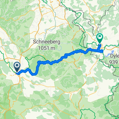
3-Landkreis-Tour
A cycling route starting in Bayreuth, Bavaria, Germany.
Overview
About this route
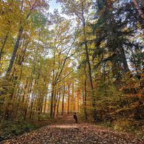
A wonderful tour starting in Bayreuth through the districts of Bayreuth, Bamberg, and Kulmbach. Special places:
- Kleinziegenfeld Valley --> Schrepfersmühle Mill
- Zultenberg --> 'Schöne Aussicht' Inn
- -:--
- Duration
- 101.4 km
- Distance
- 694 m
- Ascent
- 691 m
- Descent
- ---
- Avg. speed
- ---
- Max. altitude
Route quality
Waytypes & surfaces along the route
Waytypes
Road
32.4 km
(32 %)
Path
18.2 km
(18 %)
Surfaces
Paved
52.7 km
(52 %)
Unpaved
1 km
(1 %)
Asphalt
52.7 km
(52 %)
Loose gravel
1 km
(1 %)
Undefined
47.6 km
(47 %)
Route highlights
Points of interest along the route

Point of interest after 52.5 km
gemütliche Kneipe "Schrepfersmühle" http://www.schrepfersmuehle.de/

Point of interest after 69.1 km
Gaststätte "Schöne Aussicht" www.schoene-aussicht-zultenberg.de
Continue with Bikemap
Use, edit, or download this cycling route
You would like to ride 3-Landkreis-Tour or customize it for your own trip? Here is what you can do with this Bikemap route:
Free features
- Save this route as favorite or in collections
- Copy & plan your own version of this route
- Split it into stages to create a multi-day tour
- Sync your route with Garmin or Wahoo
Premium features
Free trial for 3 days, or one-time payment. More about Bikemap Premium.
- Navigate this route on iOS & Android
- Export a GPX / KML file of this route
- Create your custom printout (try it for free)
- Download this route for offline navigation
Discover more Premium features.
Get Bikemap PremiumFrom our community
Other popular routes starting in Bayreuth
 RoterMainQuelle (kurz)
- Distance
- 30.9 km
- Ascent
- 345 m
- Descent
- 346 m
- Location
- Bayreuth, Bavaria, Germany
 Oschenberg inkl. Arschkerbe
- Distance
- 24.8 km
- Ascent
- 306 m
- Descent
- 307 m
- Location
- Bayreuth, Bavaria, Germany
 Eine Anspruchsvolle aber schöne Tour
- Distance
- 30.7 km
- Ascent
- 63 m
- Descent
- 176 m
- Location
- Bayreuth, Bavaria, Germany
 Main-Radweg – aus Trekkingbike 5/2012 - editiert 2
- Distance
- 519.1 km
- Ascent
- 167 m
- Descent
- 411 m
- Location
- Bayreuth, Bavaria, Germany
 Von Bayreuth bis Eger
- Distance
- 93.2 km
- Ascent
- 1,167 m
- Descent
- 1,069 m
- Location
- Bayreuth, Bavaria, Germany
 11.07.23 Bayreuth-Lichtenfels (6. Etappe)
- Distance
- 76.8 km
- Ascent
- 248 m
- Descent
- 334 m
- Location
- Bayreuth, Bavaria, Germany
 Unbenannte Route
- Distance
- 190.2 km
- Ascent
- 919 m
- Descent
- 1,061 m
- Location
- Bayreuth, Bavaria, Germany
 Rund um Bayreuth
- Distance
- 37.7 km
- Ascent
- 240 m
- Descent
- 249 m
- Location
- Bayreuth, Bavaria, Germany
Open it in the app