

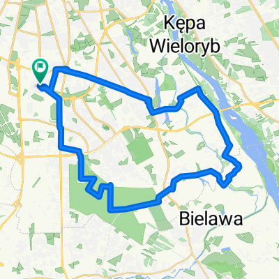
Wiązowna – Okuniew – Ossów – Kobyłka – Zielonka
A cycling route starting in Mokotów, Masovian Voivodeship, Poland.
Overview
About this route
- -:--
- Duration
- 87.5 km
- Distance
- 79 m
- Ascent
- 79 m
- Descent
- ---
- Avg. speed
- 115 m
- Max. altitude

Route quality
Waytypes & surfaces along the route
Waytypes
Quiet road
28.9 km
(33 %)
Path
18.4 km
(21 %)
Surfaces
Paved
46.4 km
(53 %)
Unpaved
21 km
(24 %)
Asphalt
41.1 km
(47 %)
Ground
7 km
(8 %)
Route highlights
Points of interest along the route
Point of interest after 28.1 km
Pałac z 1787 r. Szymona Neuman
Point of interest after 29.6 km
Parafia rzymskokatolicka św. Wojciecha
Point of interest after 43.4 km
Ruiny Pałacu Łubieńskich
Point of interest after 43.5 km
Church. St. Stanislaus Kostka
Point of interest after 51.9 km
Cmentarz Poległych w Bitwie Warszawskiej 1920 r.
Drinking water after 54.7 km
Point of interest after 56.1 km
dawna Willa "Urocza"
Point of interest after 57.1 km
Parafia Świętej Trójcy w Kobyłce
Drinking water after 59.6 km
Point of interest after 64 km
Willa
Drinking water after 65.7 km
Continue with Bikemap
Use, edit, or download this cycling route
You would like to ride Wiązowna – Okuniew – Ossów – Kobyłka – Zielonka or customize it for your own trip? Here is what you can do with this Bikemap route:
Free features
- Save this route as favorite or in collections
- Copy & plan your own version of this route
- Split it into stages to create a multi-day tour
- Sync your route with Garmin or Wahoo
Premium features
Free trial for 3 days, or one-time payment. More about Bikemap Premium.
- Navigate this route on iOS & Android
- Export a GPX / KML file of this route
- Create your custom printout (try it for free)
- Download this route for offline navigation
Discover more Premium features.
Get Bikemap PremiumFrom our community
Other popular routes starting in Mokotów
 Służewiec - Wilanów - Okrzeszyn - Powsin - Kabaty - Służewiec. CLONED FROM ROUTE 455989
- Distance
- 35.8 km
- Ascent
- 69 m
- Descent
- 69 m
- Location
- Mokotów, Masovian Voivodeship, Poland
 just~~~~~~
- Distance
- 9.8 km
- Ascent
- 25 m
- Descent
- 19 m
- Location
- Mokotów, Masovian Voivodeship, Poland
 Rezerwat im. Króla Jana Sobieskiego – Zagórze – Wiązowna – Józefów
- Distance
- 60.8 km
- Ascent
- 45 m
- Descent
- 44 m
- Location
- Mokotów, Masovian Voivodeship, Poland
 W-wa -> Otwock -> G.Kalwaria ->Konst.->Wwa
- Distance
- 70.3 km
- Ascent
- 49 m
- Descent
- 46 m
- Location
- Mokotów, Masovian Voivodeship, Poland
 Warszawa
- Distance
- 25.3 km
- Ascent
- 106 m
- Descent
- 104 m
- Location
- Mokotów, Masovian Voivodeship, Poland
 Konstancin-Jeziorna – Góra Kalwaria – Czersk
- Distance
- 71.8 km
- Ascent
- 74 m
- Descent
- 77 m
- Location
- Mokotów, Masovian Voivodeship, Poland
 Warszawa-Grodzisk-Mszczonów-Tarczyn-Góra Kalwaria-Warszawa
- Distance
- 148.3 km
- Ascent
- 155 m
- Descent
- 154 m
- Location
- Mokotów, Masovian Voivodeship, Poland
![Pętla Sulejówek - Karczew - Kalwaria - [Asfalt]](https://media.bikemap.net/routes/17550072/staticmaps/in_8f1f345a-37dd-435b-bb9f-f7b80be71618_400x400_bikemap-2021-3D-static.png) Pętla Sulejówek - Karczew - Kalwaria - [Asfalt]
Pętla Sulejówek - Karczew - Kalwaria - [Asfalt]- Distance
- 150.3 km
- Ascent
- 297 m
- Descent
- 298 m
- Location
- Mokotów, Masovian Voivodeship, Poland
Open it in the app