
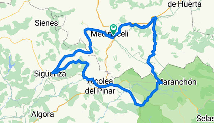
VUELTA MEDINACELI. Aros de Jalón, Puerto Sagides, Alcolea, Siguenza, Ambrona, Medinaceli alto
A cycling route starting in Medinaceli, Castille and León, Spain.
Overview
About this route
- 7 h 2 min
- Duration
- 124.9 km
- Distance
- 2,726 m
- Ascent
- 2,731 m
- Descent
- 17.8 km/h
- Avg. speed
- ---
- Max. altitude

Route quality
Waytypes & surfaces along the route
Waytypes
Road
78.7 km
(63 %)
Cycleway
17.5 km
(14 %)
Surfaces
Paved
61.2 km
(49 %)
Unpaved
3.7 km
(3 %)
Asphalt
61.2 km
(49 %)
Unpaved (undefined)
2.5 km
(2 %)
Continue with Bikemap
Use, edit, or download this cycling route
You would like to ride VUELTA MEDINACELI. Aros de Jalón, Puerto Sagides, Alcolea, Siguenza, Ambrona, Medinaceli alto or customize it for your own trip? Here is what you can do with this Bikemap route:
Free features
- Save this route as favorite or in collections
- Copy & plan your own version of this route
- Split it into stages to create a multi-day tour
- Sync your route with Garmin or Wahoo
Premium features
Free trial for 3 days, or one-time payment. More about Bikemap Premium.
- Navigate this route on iOS & Android
- Export a GPX / KML file of this route
- Create your custom printout (try it for free)
- Download this route for offline navigation
Discover more Premium features.
Get Bikemap PremiumFrom our community
Other popular routes starting in Medinaceli
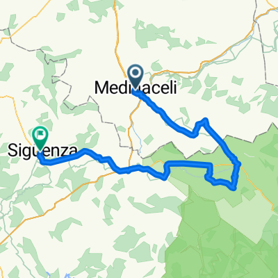
 Plaza del Carmen 6, Medinaceli nach Plaza del Obispo Don Bernardo 3, Sigüenza
- Distance
- 32.7 km
- Ascent
- 150 m
- Descent
- 410 m
- Location
- Medinaceli, Castille and León, Spain
 VUELTA MEDINACELI. Aros de Jalón, Puerto Sagides, Alcolea, Siguenza, Ambrona, Medinaceli alto
- Distance
- 124.9 km
- Ascent
- 2,726 m
- Descent
- 2,731 m
- Location
- Medinaceli, Castille and León, Spain
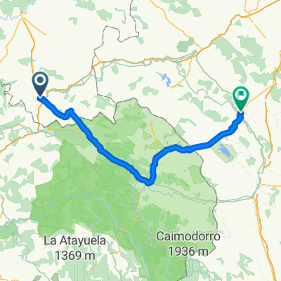
 Camino-del-Cid_5: Sigüenza - Medinaceli
- Distance
- 82.9 km
- Ascent
- 720 m
- Descent
- 939 m
- Location
- Medinaceli, Castille and León, Spain
 Soria: Sigüenza, Medinaceli y Atienza
- Distance
- 104.3 km
- Ascent
- 1,343 m
- Descent
- 1,344 m
- Location
- Medinaceli, Castille and León, Spain
 Camino del Cid. Etapa Medinaceli-Daroca
- Distance
- 131.8 km
- Ascent
- 804 m
- Descent
- 1,216 m
- Location
- Medinaceli, Castille and León, Spain
 Medinaceli Santa Maria de Huerta
- Distance
- 33.1 km
- Ascent
- 80 m
- Descent
- 504 m
- Location
- Medinaceli, Castille and León, Spain
 VUELTA A MEDINACELI (Pto. Sagides, Alcolea, Siguenza, Torralba)
- Distance
- 126.2 km
- Ascent
- 1,100 m
- Descent
- 1,097 m
- Location
- Medinaceli, Castille and León, Spain
 Entre Medinaceli y Arcos de Jalón
- Distance
- 56.2 km
- Ascent
- 721 m
- Descent
- 716 m
- Location
- Medinaceli, Castille and León, Spain
Open it in the app