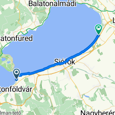
Rege utca - Csók István sétány
- 24.8 km
- 79 m
- 83 m
- Balatonföldvár, Somogy County, Hungary
A cycling route starting in Balatonföldvár, Somogy County, Hungary.
Overview
created this 4 years ago

Route quality
Track
24.9 km
(67 %)
Quiet road
4.8 km
(13 %)
Paved
8.2 km
(22 %)
Unpaved
17.5 km
(47 %)
Ground
16.4 km
(44 %)
Asphalt
6.7 km
(18 %)
Continue with Bikemap
You would like to ride Kőröshegyi tekergés or customize it for your own trip? Here is what you can do with this Bikemap route:
Free trial for 3 days, or one-time payment. More about Bikemap Premium.
Discover more Premium features.
Get Bikemap PremiumFrom our community
Open it in the app