

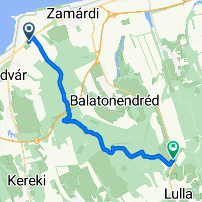
Kőrös hegyi tekergés 2.
A cycling route starting in Balatonföldvár, Somogy County, Hungary.
Overview
About this route
- -:--
- Duration
- 42 km
- Distance
- 614 m
- Ascent
- 616 m
- Descent
- ---
- Avg. speed
- 311 m
- Max. altitude
Route quality
Waytypes & surfaces along the route
Waytypes
Track
26.4 km
(63 %)
Quiet road
8.8 km
(21 %)
Surfaces
Paved
11.3 km
(27 %)
Unpaved
18 km
(43 %)
Ground
14.3 km
(34 %)
Asphalt
9.6 km
(23 %)
Continue with Bikemap
Use, edit, or download this cycling route
You would like to ride Kőrös hegyi tekergés 2. or customize it for your own trip? Here is what you can do with this Bikemap route:
Free features
- Save this route as favorite or in collections
- Copy & plan your own version of this route
- Sync your route with Garmin or Wahoo
Premium features
Free trial for 3 days, or one-time payment. More about Bikemap Premium.
- Navigate this route on iOS & Android
- Export a GPX / KML file of this route
- Create your custom printout (try it for free)
- Download this route for offline navigation
Discover more Premium features.
Get Bikemap PremiumFrom our community
Other popular routes starting in Balatonföldvár
 Útvonal ide: Széchenyi István utca
- Distance
- 12.4 km
- Ascent
- 133 m
- Descent
- 179 m
- Location
- Balatonföldvár, Somogy County, Hungary
 Kőrös hegyi tekergés 2.
- Distance
- 42 km
- Ascent
- 614 m
- Descent
- 616 m
- Location
- Balatonföldvár, Somogy County, Hungary
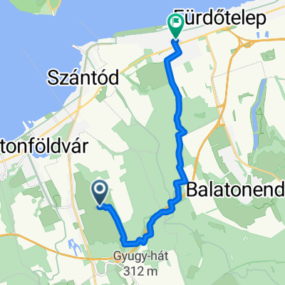
 Szántód-Jaba-puszta
- Distance
- 14 km
- Ascent
- 261 m
- Descent
- 233 m
- Location
- Balatonföldvár, Somogy County, Hungary
 Gasztro route to Siófok 💪
- Distance
- 12.5 km
- Ascent
- 17 m
- Descent
- 18 m
- Location
- Balatonföldvár, Somogy County, Hungary
 Széchenyi Imre utca - Somogyi Béla utca
- Distance
- 41.7 km
- Ascent
- 752 m
- Descent
- 754 m
- Location
- Balatonföldvár, Somogy County, Hungary
 Zrínyi utca 8, Szántód - Zrínyi utca 6, Szántód
- Distance
- 65.8 km
- Ascent
- 503 m
- Descent
- 455 m
- Location
- Balatonföldvár, Somogy County, Hungary
 Ménes utca, Kőröshegy - Batthyány Lajos utca, Zamárdi
- Distance
- 11.4 km
- Ascent
- 201 m
- Descent
- 281 m
- Location
- Balatonföldvár, Somogy County, Hungary
 Kőröshegyi utca, Balatonföldvár - Kőröshegyi utca, Balatonföldvár
- Distance
- 25.7 km
- Ascent
- 131 m
- Descent
- 130 m
- Location
- Balatonföldvár, Somogy County, Hungary
Open it in the app