

Aigenberg
A cycling route starting in Flachau, Salzburg, Austria.
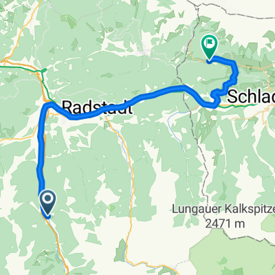
Overview
About this route
Charakteristik:
Leichte MTB-Tour mit einem langen Anstieg über ca. 400 Höhenmeter.
Ausgangs- & Zielpunkt:
Tourismusinformation Flachau
Streckenverlauf:
Start Tourismusinfo Flachau - talauswärts zum Kreisverkehr Ortsanfang - geradeaus weiter (2. Ausfhart) Richtung Reitdorf - nach Gemeindeamt links abbiegen - nach ca. 50 m rechts Richtung Reitecksee - beim Reiteck Badesee geradeaus und weiter der Straße nach rechts folgen - an der nächsten Kreuzung (neben Aigenstadl) links - über den Aigenberg bis zum Schranken - Start der Forststraße Richtung Eben (schöne Aussichtspunkte entlang der Strecke - Ennstalblick) - nach Unterführung rechts Richtung Badesee Eben (Sägewerk Brandstätter) - rechts über Autobahnbrücke - danach links abzweigen und retour über Ennsradweg zur Tourismusinfo Flachau
- -:--
- Duration
- 21.4 km
- Distance
- 498 m
- Ascent
- 498 m
- Descent
- ---
- Avg. speed
- ---
- Max. altitude

Route quality
Waytypes & surfaces along the route
Waytypes
Track
8.8 km
(41 %)
Quiet road
5.1 km
(24 %)
Surfaces
Paved
11.5 km
(54 %)
Unpaved
6.3 km
(30 %)
Asphalt
11.5 km
(54 %)
Gravel
6.3 km
(30 %)
Undefined
3.6 km
(17 %)
Route highlights
Points of interest along the route
Photo after 9.8 km
schöner Ausblick ins Ennstal
Continue with Bikemap
Use, edit, or download this cycling route
You would like to ride Aigenberg or customize it for your own trip? Here is what you can do with this Bikemap route:
Free features
- Save this route as favorite or in collections
- Copy & plan your own version of this route
- Sync your route with Garmin or Wahoo
Premium features
Free trial for 3 days, or one-time payment. More about Bikemap Premium.
- Navigate this route on iOS & Android
- Export a GPX / KML file of this route
- Create your custom printout (try it for free)
- Download this route for offline navigation
Discover more Premium features.
Get Bikemap PremiumFrom our community
Other popular routes starting in Flachau
 Altenmarkt - Radstadt - Trinkeralm
- Distance
- 49.7 km
- Ascent
- 995 m
- Descent
- 995 m
- Location
- Flachau, Salzburg, Austria
 Amadé Radmarathon - A Strecke
- Distance
- 150.3 km
- Ascent
- 1,479 m
- Descent
- 1,479 m
- Location
- Flachau, Salzburg, Austria
 Amadé Radmarathon - B Strecke
- Distance
- 99.5 km
- Ascent
- 0 m
- Descent
- 0 m
- Location
- Flachau, Salzburg, Austria
 Altenmarkt - Königlehen - Radstadt
- Distance
- 28.8 km
- Ascent
- 0 m
- Descent
- 0 m
- Location
- Flachau, Salzburg, Austria
 Altenmarkt - Steinwand - Sattelbauer
- Distance
- 29.2 km
- Ascent
- 1,003 m
- Descent
- 1,003 m
- Location
- Flachau, Salzburg, Austria
 Sattelbauer
- Distance
- 13.6 km
- Ascent
- 464 m
- Descent
- 464 m
- Location
- Flachau, Salzburg, Austria
 Runde: Moadörfl Wagrain, Kleinarl Steinkaralm, Jägersee, Wagrain
- Distance
- 47.6 km
- Ascent
- 2,484 m
- Descent
- 2,484 m
- Location
- Flachau, Salzburg, Austria
 EnnsRadweg1
- Distance
- 37.8 km
- Ascent
- 478 m
- Descent
- 342 m
- Location
- Flachau, Salzburg, Austria
Open it in the app