

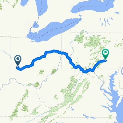
Rip Rap Road Park to Campobello Island - Roundtrip
A cycling route starting in Huber Heights, Ohio, United States.
Overview
About this route
Rip Rap Road Park to Campobello Island - Roundtrip - To first road crossing and backtrip -
- -:--
- Duration
- 7.2 km
- Distance
- 17 m
- Ascent
- 15 m
- Descent
- ---
- Avg. speed
- 238 m
- Max. altitude

Route quality
Waytypes & surfaces along the route
Waytypes
Cycleway
7.2 km
(100 %)
Continue with Bikemap
Use, edit, or download this cycling route
You would like to ride Rip Rap Road Park to Campobello Island - Roundtrip or customize it for your own trip? Here is what you can do with this Bikemap route:
Free features
- Save this route as favorite or in collections
- Copy & plan your own version of this route
- Sync your route with Garmin or Wahoo
Premium features
Free trial for 3 days, or one-time payment. More about Bikemap Premium.
- Navigate this route on iOS & Android
- Export a GPX / KML file of this route
- Create your custom printout (try it for free)
- Download this route for offline navigation
Discover more Premium features.
Get Bikemap PremiumFrom our community
Other popular routes starting in Huber Heights
 6712 Longford Rd, Huber Heights to 315 E First St, Dayton
- Distance
- 42.3 km
- Ascent
- 133 m
- Descent
- 210 m
- Location
- Huber Heights, Ohio, United States
 6100–6118 Tomberg St, Huber Heights to 3711 Inpark Dr, Dayton
- Distance
- 7.8 km
- Ascent
- 4 m
- Descent
- 38 m
- Location
- Huber Heights, Ohio, United States
 From Dayton to Harrisburg
- Distance
- 1,055.3 km
- Ascent
- 9,874 m
- Descent
- 9,994 m
- Location
- Huber Heights, Ohio, United States
 Rip Rap Station to Adams Street
- Distance
- 27.9 km
- Ascent
- 70 m
- Descent
- 50 m
- Location
- Huber Heights, Ohio, United States
 Rip Road Park to Firemen's Activity Center Needmore Road - Roundtrip on GMBT
- Distance
- 10.6 km
- Ascent
- 31 m
- Descent
- 29 m
- Location
- Huber Heights, Ohio, United States
 Huber Heights to 81–99 E Monument Ave, Dayton
- Distance
- 23.3 km
- Ascent
- 68 m
- Descent
- 145 m
- Location
- Huber Heights, Ohio, United States
 Huber Heights to Huber Heights
- Distance
- 39.8 km
- Ascent
- 249 m
- Descent
- 250 m
- Location
- Huber Heights, Ohio, United States
 Rip Road Park to Miami River Dayton on GMBT
- Distance
- 17.8 km
- Ascent
- 18 m
- Descent
- 17 m
- Location
- Huber Heights, Ohio, United States
Open it in the app