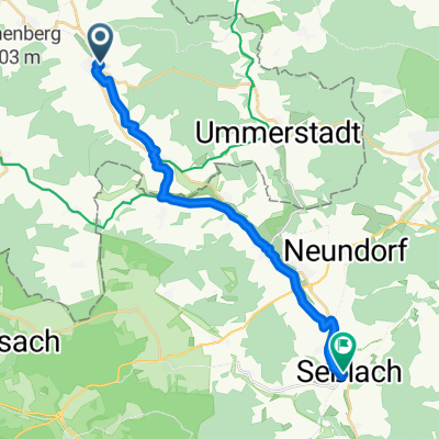
Von Hellingen durchs Unterland
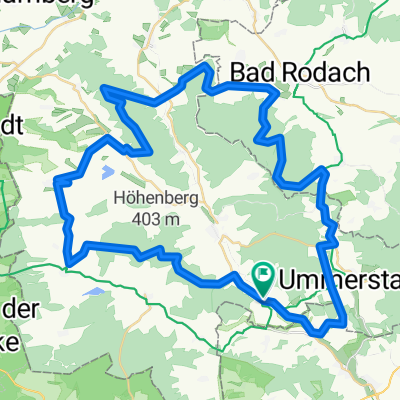
A cycling route starting in Hellingen, Thuringia, Germany.
Overview
About this route
<p>beautiful route through the forests,</p>
<p>slightly hilly - also suitable for the untrained.</p>
<p>A particular highlight is the circular path around Straufhain, one can relax comfortably with coffee and cake at Georgenturm in Rodach and at the café in Bad Colberg</p>
Translated, show original (German)- -:--
- Duration
- 54.9 km
- Distance
- 578 m
- Ascent
- 577 m
- Descent
- ---
- Avg. speed
- ---
- Max. altitude
Route quality
Waytypes & surfaces along the route
Waytypes
Track
38.4 km
(70 %)
Quiet road
12.1 km
(22 %)
Surfaces
Paved
13.2 km
(24 %)
Unpaved
37.3 km
(68 %)
Gravel
21.4 km
(39 %)
Asphalt
13.2 km
(24 %)
Continue with Bikemap
Use, edit, or download this cycling route
You would like to ride Von Hellingen durchs Unterland or customize it for your own trip? Here is what you can do with this Bikemap route:
Free features
- Save this route as favorite or in collections
- Copy & plan your own version of this route
- Sync your route with Garmin or Wahoo
Premium features
Free trial for 3 days, or one-time payment. More about Bikemap Premium.
- Navigate this route on iOS & Android
- Export a GPX / KML file of this route
- Create your custom printout (try it for free)
- Download this route for offline navigation
Discover more Premium features.
Get Bikemap PremiumFrom our community
Other popular routes starting in Hellingen
- Grünes Band DE 06/14: Poppenhausen - Frankenheim (Rhön)
- Distance
- 75.8 km
- Ascent
- 1,271 m
- Descent
- 836 m
- Location
- Hellingen, Thuringia, Germany
- Von Hellingen durchs Unterland
- Distance
- 54.9 km
- Ascent
- 578 m
- Descent
- 577 m
- Location
- Hellingen, Thuringia, Germany
- Bad Rodach Ren
- Distance
- 49.3 km
- Ascent
- 275 m
- Descent
- 262 m
- Location
- Hellingen, Thuringia, Germany
- Rieth Stausee - Altenfelden - Nonnreit 250
- Distance
- 154 km
- Ascent
- 334 m
- Descent
- 258 m
- Location
- Hellingen, Thuringia, Germany
- Heldburger Highlights Tour
- Distance
- 26 km
- Ascent
- 169 m
- Descent
- 171 m
- Location
- Hellingen, Thuringia, Germany
- Bad Colberg-Heldburg-Bad Rodach
- Distance
- 12.9 km
- Ascent
- 192 m
- Descent
- 175 m
- Location
- Hellingen, Thuringia, Germany
- Quer durch`s Land 12.Etappe Heldburg - Grimmenthal
- Distance
- 52.6 km
- Ascent
- 251 m
- Descent
- 244 m
- Location
- Hellingen, Thuringia, Germany
- Straufhain MTB
- Distance
- 55.4 km
- Ascent
- 627 m
- Descent
- 580 m
- Location
- Hellingen, Thuringia, Germany
Open it in the app