- 18.3 km
- 269 m
- 290 m
- Bischofsgrün, Bavaria, Germany
Schneebergauffahrt
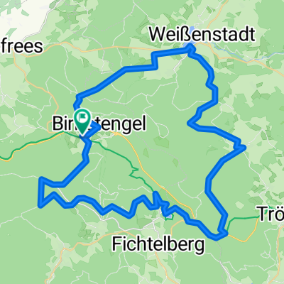
A cycling route starting in Bischofsgrün, Bavaria, Germany.
Overview
About this route
Ascent to the summit of Schneeberg from the parking lot of the Ochsenkopf Nord cable car. Bischofsgrün. Driven on 11.10.2008
- -:--
- Duration
- 5.4 km
- Distance
- 382 m
- Ascent
- 17 m
- Descent
- ---
- Avg. speed
- 1,004 m
- Max. altitude
created this 17 years ago
Route quality
Waytypes & surfaces along the route
Waytypes
Access road
2.9 km
(54 %)
Road
1.4 km
(27 %)
Surfaces
Paved
4.1 km
(77 %)
Unpaved
0.1 km
(2 %)
Asphalt
4.1 km
(77 %)
Gravel
0.1 km
(1 %)
Route highlights
Points of interest along the route

Point of interest after 0 km
Start von Parkplatzausfahrt

Point of interest after 0 km
Abzweig B303 nach Bischofsgrün

Point of interest after 0 km

Point of interest after 0 km

Point of interest after 0 km
Ortseingang Bischofsgrün

Point of interest after 0 km
Parkplatz; Wohnmobilstellplatz

Point of interest after 0 km
Blick zum Ziel

Point of interest after 0 km
Parkplatz Seilbahn Ochsenkopf Nord Bischofsgrün

Point of interest after 0.7 km
Ortsausgang Bischofsgrün

Point of interest after 0.9 km
Brücke über B303; Blick zum Schneebergturm

Point of interest after 2.2 km
Abzweig zur Schneebergstraße

Point of interest after 2.6 km
Schranke sonst immer geschlossen

Point of interest after 2.9 km

Point of interest after 3.7 km

Point of interest after 4.5 km

Point of interest after 5 km
Bergwachthütte

Point of interest after 5.2 km
Schneebergturm und Aussichtsturm Backöfele

Point of interest after 5.3 km
Backöfele

Point of interest after 5.3 km

Point of interest after 5.4 km

Point of interest after 5.4 km

Point of interest after 5.4 km

Point of interest after 5.4 km
Continue with Bikemap
Use, edit, or download this cycling route
You would like to ride Schneebergauffahrt or customize it for your own trip? Here is what you can do with this Bikemap route:
Free features
- Save this route as favorite or in collections
- Copy & plan your own version of this route
- Sync your route with Garmin or Wahoo
Premium features
Free trial for 3 days, or one-time payment. More about Bikemap Premium.
- Navigate this route on iOS & Android
- Export a GPX / KML file of this route
- Create your custom printout (try it for free)
- Download this route for offline navigation
Discover more Premium features.
Get Bikemap PremiumFrom our community
Other popular routes starting in Bischofsgrün
- Rund um den Ochsenkopf
- Hauptstraße, Bischofsgrün nach Bayreuth
- 8.5 km
- 574 m
- 237 m
- Bischofsgrün, Bavaria, Germany
- Fichtelgebirge
- 17.1 km
- 394 m
- 393 m
- Bischofsgrün, Bavaria, Germany
- Main-Radweg
- 0.2 km
- 0 m
- 17 m
- Bischofsgrün, Bavaria, Germany
- Eger Radweg
- 274.6 km
- 2,284 m
- 2,906 m
- Bischofsgrün, Bavaria, Germany
- 1.Tour Fichtelgebirge
- 47.8 km
- 1,066 m
- 1,055 m
- Bischofsgrün, Bavaria, Germany
- Saale 1 (Saalequelle-Hirschberg)
- 71.4 km
- 488 m
- 709 m
- Bischofsgrün, Bavaria, Germany
- Runde Bischofsgrün Weissenstadt
- 47.5 km
- 785 m
- 785 m
- Bischofsgrün, Bavaria, Germany
Open it in the app


