

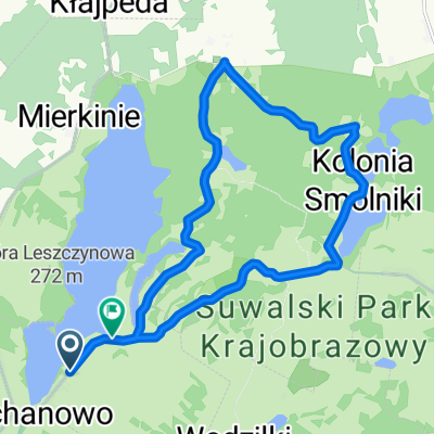
Węgorzewo dzień czwarty
A cycling route starting in Filipów, Podlasie Voivodship, Poland.
Overview
About this route
Time to summarize my routes through Warmia and Masuria in 2021. The first week included several routes near Nała Pasłęka, which was our base. Big kudos to our hosts, the Osiński family, who run room and cottage rentals as well as kayak and yacht rentals. I recommend this place to those planning a stay near the Vistula Lagoon. It is a cozy establishment with an excellent location for excursions around the area. The second week, based in Węgorzewo, was also a very nice spot in the form of a small studio in the attic of a pre-war tenement house on Kopernika Street. Most of the routes somehow followed the Green Velo trail or were close to it. But I didn’t stick rigidly to the map because for me discovering new municipalities also matters a lot. Overall, I rate all the routes I completed positively, with minor drawbacks. Mainly the surface quality of the marked trails. I will probably always associate Pomerania with roads made of concrete slabs, cobblestones, or sett stones. In the second week, routes based on the Green Velo trail were mostly a big misunderstanding. Mainly these are routes on gravel surfaces. Although, of course, there are many excellent sections of asphalt and cobblestones. Unfortunately, the wonderful idea of creating the Green Velo trail has a huge flaw. These gravel sections combined with significant elevation changes definitely exclude road cyclists, touring cyclists, and especially family groups with small children from the route. Because I congratulate any father pulling a trailer with a small child, for example on the route next to Lake Czarne or near Stańczyki. After such an outing, the knees will be shattered. Since from Węgorzewo to Gołdap along road 650 there stretches across most of the route a beautiful asphalt path, why on earth is the Green Velo trail routed parallel on the track of a former narrow-gauge railway? But on terrible gravel roads with stones the size of coconuts and with permitted agricultural traffic. I get the impression that there is a lack of cooperation among decision-makers here and double spending of funds on basically two routes instead of one but perfected to perfection. I understand the argument for separating the trail from car traffic but that is not entirely the case here. And the path along 650 is also separated and probably even safer. I have the same remarks about the sections around the Vistula Lagoon. Riding with small children in a trailer or independently on these slabs or cobblestones is a joke. The idea of Green Velo is great from a scenic and educational perspective but largely unsuitable for a wider group of cyclists. Especially families. This could be changed by improving the surface of the gravel either to asphalt or something similar to the solution on the Borów Tucholskich loop. A sandy-clay surface with fine gravel. A hard and durable base. To stop complaining now. The trip was very nice. I managed to cover 770 km and visit 39 new municipalities. The views were great in various regions. And of course many monuments, interesting places, and wonderful people. And finally, a visit to the Republic of Ściborska near Banie Mazurskie was totally out of this world. It's a family initiative for ‘forest people.’ A real blast for lovers of Indian or Inuit atmospheres. A great place. I recommend it.
- -:--
- Duration
- 77.5 km
- Distance
- 247 m
- Ascent
- 297 m
- Descent
- ---
- Avg. speed
- 269 m
- Max. altitude

Route quality
Waytypes & surfaces along the route
Waytypes
Road
32.6 km
(42 %)
Quiet road
27.9 km
(36 %)
Surfaces
Paved
61.2 km
(79 %)
Unpaved
13.2 km
(17 %)
Asphalt
61.2 km
(79 %)
Gravel
10.1 km
(13 %)
Continue with Bikemap
Use, edit, or download this cycling route
You would like to ride Węgorzewo dzień czwarty or customize it for your own trip? Here is what you can do with this Bikemap route:
Free features
- Save this route as favorite or in collections
- Copy & plan your own version of this route
- Sync your route with Garmin or Wahoo
Premium features
Free trial for 3 days, or one-time payment. More about Bikemap Premium.
- Navigate this route on iOS & Android
- Export a GPX / KML file of this route
- Create your custom printout (try it for free)
- Download this route for offline navigation
Discover more Premium features.
Get Bikemap PremiumFrom our community
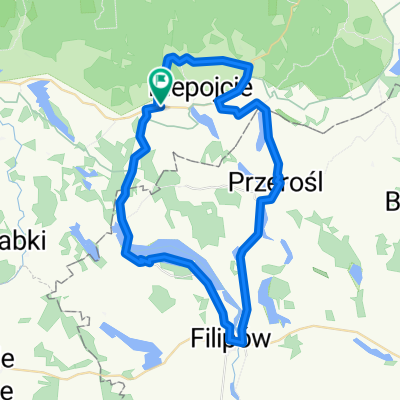
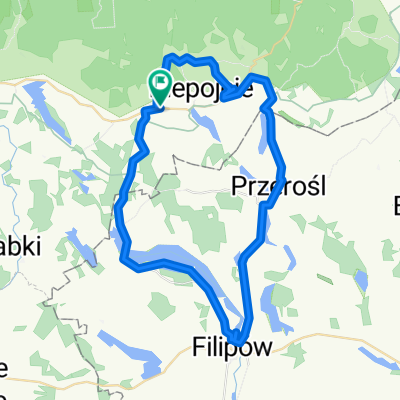
Other popular routes starting in Filipów
 Węgorzewo dzień czwarty
- Distance
- 77.5 km
- Ascent
- 247 m
- Descent
- 297 m
- Location
- Filipów, Podlasie Voivodship, Poland
 Błaskowizna do Błaskowizna
- Distance
- 14.4 km
- Ascent
- 168 m
- Descent
- 172 m
- Location
- Filipów, Podlasie Voivodship, Poland
 Błaskowizna-wiadukty w Stańczykach i z powrotem
- Distance
- 38.5 km
- Ascent
- 207 m
- Descent
- 210 m
- Location
- Filipów, Podlasie Voivodship, Poland
 Dębowa, Dubeninki do Dębowa, Dubeninki
- Distance
- 49.8 km
- Ascent
- 391 m
- Descent
- 391 m
- Location
- Filipów, Podlasie Voivodship, Poland
 Dębowa, Dubeninki do Dębowa, Dubeninki
- Distance
- 44.7 km
- Ascent
- 358 m
- Descent
- 357 m
- Location
- Filipów, Podlasie Voivodship, Poland
 Dębowa, Dubeninki do Dębowa, Dubeninki
- Distance
- 43.1 km
- Ascent
- 345 m
- Descent
- 345 m
- Location
- Filipów, Podlasie Voivodship, Poland
 RPSc-4 dzień
- Distance
- 62.2 km
- Ascent
- 122 m
- Descent
- 221 m
- Location
- Filipów, Podlasie Voivodship, Poland
 Wycieczka Nr 10/2013 – Suwalski Park Krajobrazowy- 05-09 czerwca
- Distance
- 43.9 km
- Ascent
- 284 m
- Descent
- 285 m
- Location
- Filipów, Podlasie Voivodship, Poland
Open it in the app