
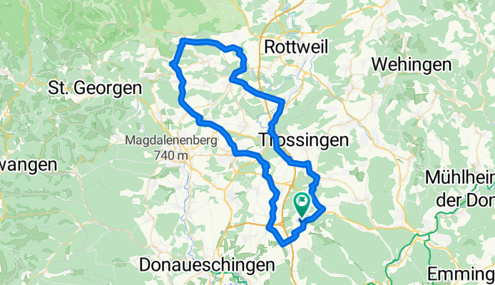
ÖFINGEN - KÖNIGSFELD - DREISSLINGEN
A cycling route starting in Talheim, Baden-Württemberg, Germany.
Overview
About this route
Öfingen - Oberbaldingen - Sunthausen - Tuningen - Mühlhausen - Schweningen - Weilersbach - oberschachbach - Neuhausen - Erdmannsweiler - Burgberg - Weiler - Flözlingen - Horgen - Niedereschbach - Deisslingen - Weigheim - Schura - Talheim - Öfingen
- -:--
- Duration
- 73.6 km
- Distance
- 773 m
- Ascent
- 767 m
- Descent
- ---
- Avg. speed
- ---
- Max. altitude
Route quality
Waytypes & surfaces along the route
Waytypes
Road
53.8 km
(73 %)
Busy road
9.4 km
(13 %)
Surfaces
Paved
68.8 km
(94 %)
Unpaved
0.7 km
(<1 %)
Asphalt
67.2 km
(91 %)
Paved (undefined)
1.2 km
(2 %)
Continue with Bikemap
Use, edit, or download this cycling route
You would like to ride ÖFINGEN - KÖNIGSFELD - DREISSLINGEN or customize it for your own trip? Here is what you can do with this Bikemap route:
Free features
- Save this route as favorite or in collections
- Copy & plan your own version of this route
- Sync your route with Garmin or Wahoo
Premium features
Free trial for 3 days, or one-time payment. More about Bikemap Premium.
- Navigate this route on iOS & Android
- Export a GPX / KML file of this route
- Create your custom printout (try it for free)
- Download this route for offline navigation
Discover more Premium features.
Get Bikemap PremiumFrom our community
Other popular routes starting in Talheim
 Schwarzwald Öfingen lockere Baaracht
- Distance
- 57.8 km
- Ascent
- 464 m
- Descent
- 476 m
- Location
- Talheim, Baden-Württemberg, Germany
 TUTTLINGENRUNDFAHRT
- Distance
- 96.4 km
- Ascent
- 970 m
- Descent
- 965 m
- Location
- Talheim, Baden-Württemberg, Germany
 Hüfingen - Rötenbach - Hammereisenbach - Donaueschingen
- Distance
- 101.7 km
- Ascent
- 747 m
- Descent
- 752 m
- Location
- Talheim, Baden-Württemberg, Germany
 Schwarzwald Öfingen - Rottweil
- Distance
- 65.5 km
- Ascent
- 462 m
- Descent
- 461 m
- Location
- Talheim, Baden-Württemberg, Germany
 ÖFINGEN - KÖNIGSFELD - DREISSLINGEN
- Distance
- 73.6 km
- Ascent
- 773 m
- Descent
- 767 m
- Location
- Talheim, Baden-Württemberg, Germany
 ALBRUNDE
- Distance
- 111.2 km
- Ascent
- 889 m
- Descent
- 876 m
- Location
- Talheim, Baden-Württemberg, Germany
 Öfingen - Königsfeld - Dreisslingen
- Distance
- 73.3 km
- Ascent
- 679 m
- Descent
- 679 m
- Location
- Talheim, Baden-Württemberg, Germany
 ÖFINGEN - BLUMEGG - TEGEN
- Distance
- 91.5 km
- Ascent
- 991 m
- Descent
- 993 m
- Location
- Talheim, Baden-Württemberg, Germany
Open it in the app