

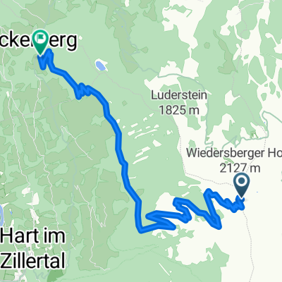
Zillertal Brandenberg Achensee
A cycling route starting in Hart im Zillertal, Tyrol, Austria.
Overview
About this route
- -:--
- Duration
- 84.9 km
- Distance
- 2,526 m
- Ascent
- 2,400 m
- Descent
- ---
- Avg. speed
- 1,116 m
- Max. altitude

Route quality
Waytypes & surfaces along the route
Waytypes
Quiet road
28.9 km
(34 %)
Road
17 km
(20 %)
Surfaces
Paved
50.1 km
(59 %)
Unpaved
7.6 km
(9 %)
Asphalt
49.2 km
(58 %)
Gravel
5.9 km
(7 %)
Continue with Bikemap
Use, edit, or download this cycling route
You would like to ride Zillertal Brandenberg Achensee or customize it for your own trip? Here is what you can do with this Bikemap route:
Free features
- Save this route as favorite or in collections
- Copy & plan your own version of this route
- Split it into stages to create a multi-day tour
- Sync your route with Garmin or Wahoo
Premium features
Free trial for 3 days, or one-time payment. More about Bikemap Premium.
- Navigate this route on iOS & Android
- Export a GPX / KML file of this route
- Create your custom printout (try it for free)
- Download this route for offline navigation
Discover more Premium features.
Get Bikemap PremiumFrom our community
Other popular routes starting in Hart im Zillertal
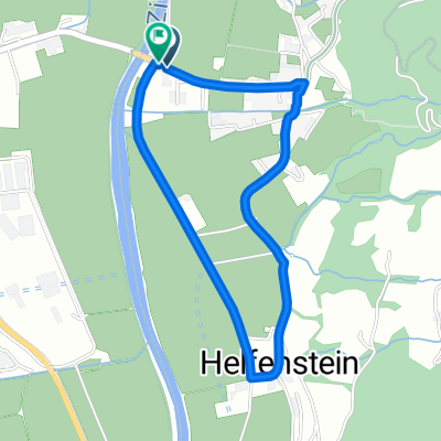
 Niederhart 11, Hart im Zillertal nach Pertisau 58
- Distance
- 24.7 km
- Ascent
- 605 m
- Descent
- 237 m
- Location
- Hart im Zillertal, Tyrol, Austria
 Zillertal Brandenberg Achensee
- Distance
- 84.9 km
- Ascent
- 2,526 m
- Descent
- 2,400 m
- Location
- Hart im Zillertal, Tyrol, Austria
 Niederhart 5, Hart im Zillertal nach Hauptstraße 475, Mayrhofen
- Distance
- 24.2 km
- Ascent
- 179 m
- Descent
- 102 m
- Location
- Hart im Zillertal, Tyrol, Austria
 Wiedersberger Horn -> Reither Kogel
- Distance
- 10.9 km
- Ascent
- 45 m
- Descent
- 987 m
- Location
- Hart im Zillertal, Tyrol, Austria
 Panorama Hart to Bruck
- Distance
- 19.5 km
- Ascent
- 337 m
- Descent
- 339 m
- Location
- Hart im Zillertal, Tyrol, Austria
 Hart nach Ramsau
- Distance
- 20.1 km
- Ascent
- 169 m
- Descent
- 214 m
- Location
- Hart im Zillertal, Tyrol, Austria
 Zillertal - Achensee
- Distance
- 29.8 km
- Ascent
- 454 m
- Descent
- 97 m
- Location
- Hart im Zillertal, Tyrol, Austria
 test
test- Distance
- 2.8 km
- Ascent
- 37 m
- Descent
- 39 m
- Location
- Hart im Zillertal, Tyrol, Austria
Open it in the app