

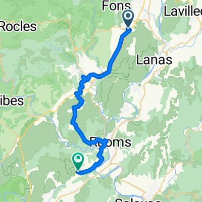
De Grand'Rue, Balazuc à Rue Voltaire, Le Thor
A cycling route starting in Lachapelle-sous-Aubenas, Auvergne-Rhône-Alpes, France.
Overview
About this route
- 6 h 34 min
- Duration
- 114.4 km
- Distance
- 413 m
- Ascent
- 527 m
- Descent
- 17.4 km/h
- Avg. speed
- 346 m
- Max. altitude
Route quality
Waytypes & surfaces along the route
Waytypes
Quiet road
52.9 km
(46 %)
Road
28.5 km
(25 %)
Surfaces
Paved
61.7 km
(54 %)
Unpaved
1.8 km
(2 %)
Asphalt
58.2 km
(51 %)
Paved (undefined)
3.2 km
(3 %)
Continue with Bikemap
Use, edit, or download this cycling route
You would like to ride De Grand'Rue, Balazuc à Rue Voltaire, Le Thor or customize it for your own trip? Here is what you can do with this Bikemap route:
Free features
- Save this route as favorite or in collections
- Copy & plan your own version of this route
- Split it into stages to create a multi-day tour
- Sync your route with Garmin or Wahoo
Premium features
Free trial for 3 days, or one-time payment. More about Bikemap Premium.
- Navigate this route on iOS & Android
- Export a GPX / KML file of this route
- Create your custom printout (try it for free)
- Download this route for offline navigation
Discover more Premium features.
Get Bikemap PremiumFrom our community
Other popular routes starting in Lachapelle-sous-Aubenas
 france 2009-10 balazuc-chusclan
- Distance
- 98 km
- Ascent
- 573 m
- Descent
- 717 m
- Location
- Lachapelle-sous-Aubenas, Auvergne-Rhône-Alpes, France
 VinezacAilhonLentilleresChazeauxChassier
- Distance
- 36.2 km
- Ascent
- 468 m
- Descent
- 469 m
- Location
- Lachapelle-sous-Aubenas, Auvergne-Rhône-Alpes, France
 rondje ter verkenning
- Distance
- 48.7 km
- Ascent
- 491 m
- Descent
- 491 m
- Location
- Lachapelle-sous-Aubenas, Auvergne-Rhône-Alpes, France
 Rue du Barry, Lachapelle-sous-Aubenas à Montée de la Barnerie, Saint-Alban-Auriolles
- Distance
- 27.8 km
- Ascent
- 347 m
- Descent
- 435 m
- Location
- Lachapelle-sous-Aubenas, Auvergne-Rhône-Alpes, France
 Vakantieroute 3 70km
- Distance
- 69.5 km
- Ascent
- 535 m
- Descent
- 535 m
- Location
- Lachapelle-sous-Aubenas, Auvergne-Rhône-Alpes, France
 Vinezac_005
- Distance
- 13.2 km
- Ascent
- 225 m
- Descent
- 228 m
- Location
- Lachapelle-sous-Aubenas, Auvergne-Rhône-Alpes, France
 test
test- Distance
- 15.2 km
- Ascent
- 230 m
- Descent
- 172 m
- Location
- Lachapelle-sous-Aubenas, Auvergne-Rhône-Alpes, France
 Route 2 vanaf de camping
- Distance
- 53.7 km
- Ascent
- 432 m
- Descent
- 432 m
- Location
- Lachapelle-sous-Aubenas, Auvergne-Rhône-Alpes, France
Open it in the app