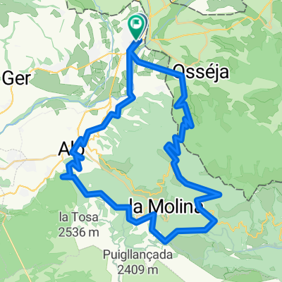
PIRINEUS ORIENTALS ETAPA 4
- 64.9 km
- 2,160 m
- 2,106 m
- la Guingueta d'Ix, Occitanie, France
A cycling route starting in la Guingueta d'Ix, Occitanie, France.
Overview
created this 4 years ago
Route quality
Road
23.5 km
32 %
Quiet road
9.6 km
13 %
Paved
47.1 km
(64 %)
Unpaved
4.4 km
(6 %)
Asphalt
47.1 km
64 %
Gravel
4.4 km
6 %
Undefined
22.1 km
30 %
Route highlights
BIVOUAC N°02 / + 110KM / 3570D+ / dimanche 01.08 soir
BIVOUAC N°07 / + 460.2KM / 11890D+ / vendredi 06.08 soir
BIVOUAC N°01 / + 40KM / 1150M D+ / samedi 31.07 soir
COL DE PEYRESOURDE
RAVITAILLEMENT
CHAPEL DE NOTRE DAME DE L'AUBEPINE
LAC
COL LUZ ARDIDEN
BIVOUAC N°08 / + 528.1KM / 13590D+ / samedi 07.08 soir
BIVOUAC N°05 / + 327.8KM / 7730D+ / mercredi 04.08 soir
COL DU TOURMALET
COL DU PORTET
COL D'ASPIN
BIVOUAC N°03 / + 181.1KM / 5040D+ / lundi 02.08 soir
BIVOUAC N°04 / + 261.2KM / 7200D+ / mardi 03.08 soir
PASSERELLE D'HOLZARTE
BIVOUAC N°09 / + 608.1KM / 15460D+ / dimanche 08.08 soir
BIVOUAC N°06 / + 397.3KM / 9190D+ / jeudi 05.08 soir
LA CHAPELLE DE3 LA MADELEINE
Lac
BIVOUAC N°10 / + 691.1KM / 16400D+ / lundi 09.08 soir
BIVOUAC N°11 / + 759.5KM / 18080D+ / mardi 10.08 soir
BIVOUAC N°12 / + 825.3KM / 19760D+ / mercredi 11.08 soir
PIC NEULOS
BIVOUAC N°14 /vendredi 13.08 soir
BIVOUAC N°13 / + 825.3KM / 19760D+ / jeudi 12.08 soir
Continue with Bikemap
You would like to ride TDP - ETAPE 13 or customize it for your own trip? Here is what you can do with this Bikemap route:
Free trial for 3 days, or one-time payment. More about Bikemap Premium.
Discover more Premium features.
Get Bikemap PremiumFrom our community
Open it in the app