Weißenborn Marienthal
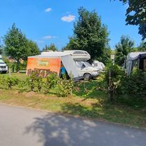
A cycling route starting in Zwickau, Saxony, Germany.
Overview
About this route
- 2 h 7 min
 - Duration
 - 17.4 km
 - Distance
 - 210 m
 - Ascent
 - 221 m
 - Descent
 - 8.2 km/h
 - Avg. speed
 - 375 m
 - Max. altitude
 
Route photos
Route quality
Waytypes & surfaces along the route
Waytypes
Quiet road
4.5 km
(26 %)
Pedestrian area
1.7 km
(10 %)
Surfaces
Paved
11.5 km
(66 %)
Unpaved
2.3 km
(13 %)
Asphalt
11.3 km
(65 %)
Gravel
2.3 km
(13 %)
Continue with Bikemap
Use, edit, or download this cycling route
You would like to ride Weißenborn Marienthal or customize it for your own trip? Here is what you can do with this Bikemap route:
Free features
- Save this route as favorite or in collections
 - Copy & plan your own version of this route
 - Sync your route with Garmin or Wahoo
 
Premium features
Free trial for 3 days, or one-time payment. More about Bikemap Premium.
- Navigate this route on iOS & Android
 - Export a GPX / KML file of this route
 - Create your custom printout (try it for free)
 - Download this route for offline navigation
 
Discover more Premium features.
Get Bikemap PremiumFrom our community
Other popular routes starting in Zwickau
ZEV Radtour 2019- Distance
 - 61.4 km
 - Ascent
 - 582 m
 - Descent
 - 584 m
 - Location
 - Zwickau, Saxony, Germany
 
Zwickau-Steipleis-Stenn-Neumark und zurück- Distance
 - 38.8 km
 - Ascent
 - 325 m
 - Descent
 - 323 m
 - Location
 - Zwickau, Saxony, Germany
 
Schönwetterrunde (Ausflug)- Distance
 - 64.6 km
 - Ascent
 - 482 m
 - Descent
 - 484 m
 - Location
 - Zwickau, Saxony, Germany
 
ZEV Radtour 2024- Distance
 - 43.2 km
 - Ascent
 - 413 m
 - Descent
 - 469 m
 - Location
 - Zwickau, Saxony, Germany
 
Zwickau nach Werdauer Straße 22A- Distance
 - 12.4 km
 - Ascent
 - 160 m
 - Descent
 - 79 m
 - Location
 - Zwickau, Saxony, Germany
 
Rund ums Absetzbecken- Distance
 - 16.4 km
 - Ascent
 - 164 m
 - Descent
 - 163 m
 - Location
 - Zwickau, Saxony, Germany
 
Weißenborn Marienthal- Distance
 - 17.4 km
 - Ascent
 - 210 m
 - Descent
 - 221 m
 - Location
 - Zwickau, Saxony, Germany
 
Südroute1- Distance
 - 43.9 km
 - Ascent
 - 452 m
 - Descent
 - 446 m
 - Location
 - Zwickau, Saxony, Germany
 
Open it in the app


