

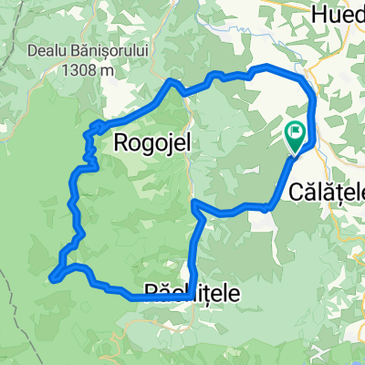
Recovered Route
A cycling route starting in Călăţele, Cluj County, Romania.
Overview
About this route
- 3 h 1 min
- Duration
- 39.4 km
- Distance
- 4,220 m
- Ascent
- 4,293 m
- Descent
- 13.1 km/h
- Avg. speed
- ---
- Max. altitude

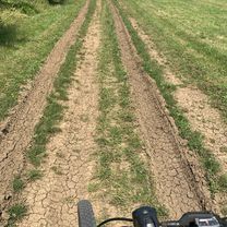
Route photos


Continue with Bikemap
Use, edit, or download this cycling route
You would like to ride Recovered Route or customize it for your own trip? Here is what you can do with this Bikemap route:
Free features
- Save this route as favorite or in collections
- Copy & plan your own version of this route
- Sync your route with Garmin or Wahoo
Premium features
Free trial for 3 days, or one-time payment. More about Bikemap Premium.
- Navigate this route on iOS & Android
- Export a GPX / KML file of this route
- Create your custom printout (try it for free)
- Download this route for offline navigation
Discover more Premium features.
Get Bikemap PremiumFrom our community
Other popular routes starting in Călăţele
 belis-albac
- Distance
- 144.8 km
- Ascent
- 1,895 m
- Descent
- 1,894 m
- Location
- Călăţele, Cluj County, Romania
 Recovered Route
- Distance
- 39.4 km
- Ascent
- 4,220 m
- Descent
- 4,293 m
- Location
- Călăţele, Cluj County, Romania
 Buteni - Rachitele - Vladeasa - Sacuieu
- Distance
- 63.8 km
- Ascent
- 1,523 m
- Descent
- 1,523 m
- Location
- Călăţele, Cluj County, Romania
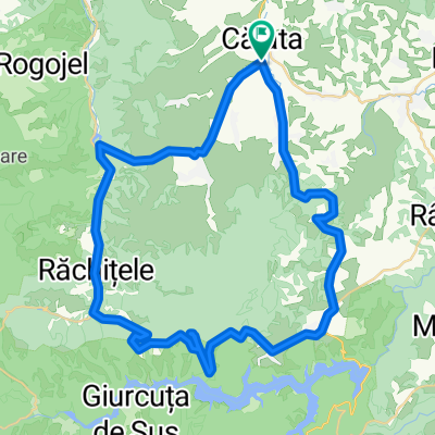
 Calatele-Somesul rece
- Distance
- 119.6 km
- Ascent
- 2,968 m
- Descent
- 2,967 m
- Location
- Călăţele, Cluj County, Romania
 18.05.2014 Belis,Dealul Botii, Vf Magura Calatele 1404m,Rachitele
- Distance
- 55.5 km
- Ascent
- 947 m
- Descent
- 947 m
- Location
- Călăţele, Cluj County, Romania
 Belis
Belis- Distance
- 51.1 km
- Ascent
- 848 m
- Descent
- 849 m
- Location
- Călăţele, Cluj County, Romania
 Belis Rachitele
- Distance
- 50.4 km
- Ascent
- 874 m
- Descent
- 875 m
- Location
- Călăţele, Cluj County, Romania
 DN1R to DN1R
- Distance
- 7.9 km
- Ascent
- 2 m
- Descent
- 127 m
- Location
- Călăţele, Cluj County, Romania
Open it in the app