

Über Wiedenbrück-Delbrück-Sennelager-Kreuzkrug-Augustdorf
A cycling route starting in Oerlinghausen, North Rhine-Westphalia, Germany.
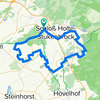
Overview
About this route
Gute Rollerstrecke auf landschaftlich schönen Wegen. Erst ab Schlangen hügelig. Ab Kreuzkrug (unterhalb Gauseköte) durchs Übungsgelände zur Panzerbrücke (die Ringstrasse wird auch immer schlechter!!!). Von da an "Kette rechts!".
- -:--
- Duration
- 114.9 km
- Distance
- 215 m
- Ascent
- 215 m
- Descent
- ---
- Avg. speed
- ---
- Max. altitude

Route quality
Waytypes & surfaces along the route
Waytypes
Quiet road
46.7 km
(41 %)
Busy road
20.7 km
(18 %)
Surfaces
Paved
99.5 km
(87 %)
Unpaved
3.3 km
(3 %)
Asphalt
94.6 km
(82 %)
Paving stones
3.2 km
(3 %)
Continue with Bikemap
Use, edit, or download this cycling route
You would like to ride Über Wiedenbrück-Delbrück-Sennelager-Kreuzkrug-Augustdorf or customize it for your own trip? Here is what you can do with this Bikemap route:
Free features
- Save this route as favorite or in collections
- Copy & plan your own version of this route
- Split it into stages to create a multi-day tour
- Sync your route with Garmin or Wahoo
Premium features
Free trial for 3 days, or one-time payment. More about Bikemap Premium.
- Navigate this route on iOS & Android
- Export a GPX / KML file of this route
- Create your custom printout (try it for free)
- Download this route for offline navigation
Discover more Premium features.
Get Bikemap PremiumFrom our community
Other popular routes starting in Oerlinghausen
 Schl. Holte Sennebäche
- Distance
- 36.3 km
- Ascent
- 90 m
- Descent
- 92 m
- Location
- Oerlinghausen, North Rhine-Westphalia, Germany
 Über Wiedenbrück-Delbrück-Sennelager-Kreuzkrug-Augustdorf
- Distance
- 114.9 km
- Ascent
- 215 m
- Descent
- 215 m
- Location
- Oerlinghausen, North Rhine-Westphalia, Germany
 Tönsberg bis Teiche
- Distance
- 25.5 km
- Ascent
- 508 m
- Descent
- 515 m
- Location
- Oerlinghausen, North Rhine-Westphalia, Germany
 Gartenweg 26, Schloß Holte-Stukenbrock nach Landerdamm 22, Schloß Holte-Stukenbrock
- Distance
- 51.3 km
- Ascent
- 465 m
- Descent
- 466 m
- Location
- Oerlinghausen, North Rhine-Westphalia, Germany
 Leopoldshöhe>Steinhorster Becken
- Distance
- 72.6 km
- Ascent
- 275 m
- Descent
- 254 m
- Location
- Oerlinghausen, North Rhine-Westphalia, Germany
 Rund um Leopoldshöhe von HaPe
- Distance
- 24.7 km
- Ascent
- 133 m
- Descent
- 139 m
- Location
- Oerlinghausen, North Rhine-Westphalia, Germany
 Von Schloss Holte zur Sparrenburg (Hermannsweg)
- Distance
- 24.3 km
- Ascent
- 415 m
- Descent
- 373 m
- Location
- Oerlinghausen, North Rhine-Westphalia, Germany
 Fahrt durchs Ochsengehege
- Distance
- 16.5 km
- Ascent
- 403 m
- Descent
- 403 m
- Location
- Oerlinghausen, North Rhine-Westphalia, Germany
Open it in the app