

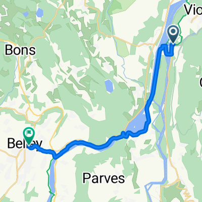
De Conjux à Vions - Chanaz
A cycling route starting in Châtillon, Auvergne-Rhône-Alpes, France.
Overview
About this route
- 3 h 17 min
- Duration
- 13 km
- Distance
- 51 m
- Ascent
- 45 m
- Descent
- 4 km/h
- Avg. speed
- 240 m
- Max. altitude

Route photos

Route quality
Waytypes & surfaces along the route
Waytypes
Access road
3 km
(23 %)
Road
2.9 km
(22 %)
Surfaces
Paved
8.8 km
(68 %)
Unpaved
0.3 km
(2 %)
Asphalt
8.8 km
(68 %)
Gravel
0.3 km
(2 %)
Undefined
3.9 km
(30 %)
Continue with Bikemap
Use, edit, or download this cycling route
You would like to ride De Conjux à Vions - Chanaz or customize it for your own trip? Here is what you can do with this Bikemap route:
Free features
- Save this route as favorite or in collections
- Copy & plan your own version of this route
- Sync your route with Garmin or Wahoo
Premium features
Free trial for 3 days, or one-time payment. More about Bikemap Premium.
- Navigate this route on iOS & Android
- Export a GPX / KML file of this route
- Create your custom printout (try it for free)
- Download this route for offline navigation
Discover more Premium features.
Get Bikemap PremiumFrom our community
Other popular routes starting in Châtillon
 De Conjux à Vions - Chanaz
- Distance
- 13 km
- Ascent
- 51 m
- Descent
- 45 m
- Location
- Châtillon, Auvergne-Rhône-Alpes, France
 Etape 3 (58km) - Camping de Chanaz à celui de Morestel
- Distance
- 58.4 km
- Ascent
- 263 m
- Descent
- 284 m
- Location
- Châtillon, Auvergne-Rhône-Alpes, France
 Dag2 laatse deel
- Distance
- 14.2 km
- Ascent
- 85 m
- Descent
- 43 m
- Location
- Châtillon, Auvergne-Rhône-Alpes, France
 Chanaz Ontex
- Distance
- 35.5 km
- Ascent
- 1,192 m
- Descent
- 1,176 m
- Location
- Châtillon, Auvergne-Rhône-Alpes, France
 chanazJongieuChanaz
- Distance
- 37.5 km
- Ascent
- 1,135 m
- Descent
- 1,143 m
- Location
- Châtillon, Auvergne-Rhône-Alpes, France
 67km2100hmSaintPierreDeCurtille
- Distance
- 67.3 km
- Ascent
- 0 m
- Descent
- 0 m
- Location
- Châtillon, Auvergne-Rhône-Alpes, France
 Alpen 2015 - Dag 5
- Distance
- 95.9 km
- Ascent
- 2,079 m
- Descent
- 1,865 m
- Location
- Châtillon, Auvergne-Rhône-Alpes, France
 EuroVelo17-02-Chanaz-Lyon
- Distance
- 129.7 km
- Ascent
- 614 m
- Descent
- 683 m
- Location
- Châtillon, Auvergne-Rhône-Alpes, France
Open it in the app