
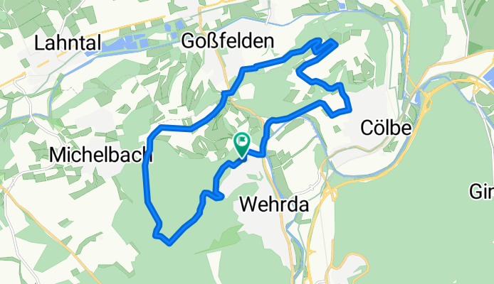
14k tour
A cycling route starting in Cölbe, Hesse, Germany.
Overview
About this route
- -:--
- Duration
- 14 km
- Distance
- 277 m
- Ascent
- 277 m
- Descent
- ---
- Avg. speed
- ---
- Max. altitude
Continue with Bikemap
Use, edit, or download this cycling route
You would like to ride 14k tour or customize it for your own trip? Here is what you can do with this Bikemap route:
Free features
- Save this route as favorite or in collections
- Copy & plan your own version of this route
- Sync your route with Garmin or Wahoo
Premium features
Free trial for 3 days, or one-time payment. More about Bikemap Premium.
- Navigate this route on iOS & Android
- Export a GPX / KML file of this route
- Create your custom printout (try it for free)
- Download this route for offline navigation
Discover more Premium features.
Get Bikemap PremiumFrom our community
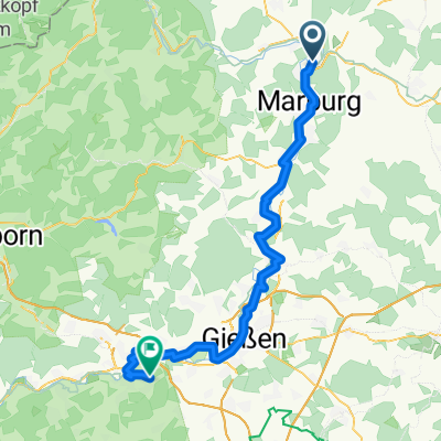
Other popular routes starting in Cölbe
 lahntal gladenbach
- Distance
- 76.6 km
- Ascent
- 498 m
- Descent
- 496 m
- Location
- Cölbe, Hesse, Germany
 Radweg Deutsche Einheit Etappe 3
- Distance
- 59.8 km
- Ascent
- 415 m
- Descent
- 356 m
- Location
- Cölbe, Hesse, Germany
 lahntal gladenbach
- Distance
- 76.6 km
- Ascent
- 498 m
- Descent
- 496 m
- Location
- Cölbe, Hesse, Germany
 Good Times - Gravelausfahrt am 14. Mai 2024
- Distance
- 26.1 km
- Ascent
- 246 m
- Descent
- 246 m
- Location
- Cölbe, Hesse, Germany
 Frankenberg-Rosenthal
- Distance
- 59.3 km
- Ascent
- 551 m
- Descent
- 551 m
- Location
- Cölbe, Hesse, Germany
 Lahntalradweg_E2_Cölbe-Wetzlar_Leitz
- Distance
- 65.1 km
- Ascent
- 349 m
- Descent
- 248 m
- Location
- Cölbe, Hesse, Germany
 Von Lahntal bis Wetzlar
- Distance
- 64.8 km
- Ascent
- 202 m
- Descent
- 248 m
- Location
- Cölbe, Hesse, Germany
 Goßfelden - Battenberg
- Distance
- 25.9 km
- Ascent
- 343 m
- Descent
- 174 m
- Location
- Cölbe, Hesse, Germany
Open it in the app