

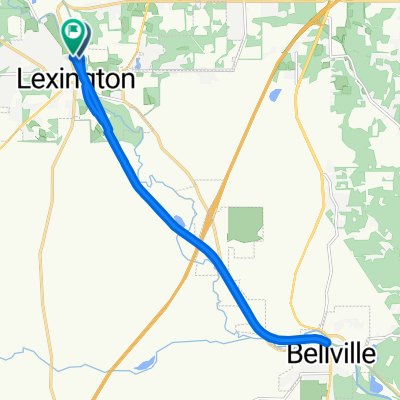
144 Plymouth St, Lexington to Richland B and O Trail, Bellville
A cycling route starting in Lexington, Ohio, United States.
Overview
About this route
- 27 min
- Duration
- 9.7 km
- Distance
- 17 m
- Ascent
- 33 m
- Descent
- 21.4 km/h
- Avg. speed
- ---
- Max. altitude
Route quality
Waytypes & surfaces along the route
Waytypes
Cycleway
8.8 km
(90 %)
Quiet road
0.5 km
(5 %)
Surfaces
Paved
0.2 km
(2 %)
Asphalt
0.2 km
(2 %)
Undefined
9.5 km
(98 %)
Continue with Bikemap
Use, edit, or download this cycling route
You would like to ride 144 Plymouth St, Lexington to Richland B and O Trail, Bellville or customize it for your own trip? Here is what you can do with this Bikemap route:
Free features
- Save this route as favorite or in collections
- Copy & plan your own version of this route
- Sync your route with Garmin or Wahoo
Premium features
Free trial for 3 days, or one-time payment. More about Bikemap Premium.
- Navigate this route on iOS & Android
- Export a GPX / KML file of this route
- Create your custom printout (try it for free)
- Download this route for offline navigation
Discover more Premium features.
Get Bikemap PremiumFrom our community
Other popular routes starting in Lexington
 Richland B and O Trail, Mansfield to 144 Plymouth St, Lexington
- Distance
- 4.3 km
- Ascent
- 22 m
- Descent
- 17 m
- Location
- Lexington, Ohio, United States
 7471 SR-97, Mansfield to Richland B and O Trail, Bellville
- Distance
- 18.7 km
- Ascent
- 213 m
- Descent
- 237 m
- Location
- Lexington, Ohio, United States
 lex to johns to blvl to lex
- Distance
- 35 km
- Ascent
- 234 m
- Descent
- 241 m
- Location
- Lexington, Ohio, United States
 South Mill Street 55, Lexington to South Mill Street 55, Lexington
- Distance
- 11.2 km
- Ascent
- 32 m
- Descent
- 32 m
- Location
- Lexington, Ohio, United States
 144 Plymouth St, Lexington to Richland B and O Trail, Bellville
- Distance
- 9.7 km
- Ascent
- 17 m
- Descent
- 33 m
- Location
- Lexington, Ohio, United States
 Steady ride in Mount Gilead
- Distance
- 8.2 km
- Ascent
- 57 m
- Descent
- 47 m
- Location
- Lexington, Ohio, United States
 Moderate route in Lexington
- Distance
- 19.5 km
- Ascent
- 52 m
- Descent
- 55 m
- Location
- Lexington, Ohio, United States
 Slow ride in Mount Gilead
- Distance
- 5.5 km
- Ascent
- 69 m
- Descent
- 10 m
- Location
- Lexington, Ohio, United States
Open it in the app