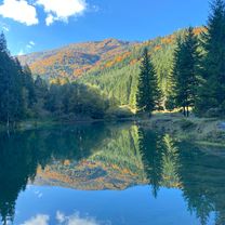
Dolný Kubín - Srňacie - Leštiny - Vyšný Kubín
A cycling route starting in Dolný Kubín, Žilina Region, Slovakia.
Overview
About this route
Asfalt - cesty, polne / lesne cesty
- -:--
- Duration
- 15.5 km
- Distance
- 281 m
- Ascent
- 279 m
- Descent
- ---
- Avg. speed
- 735 m
- Max. altitude
Route quality
Waytypes & surfaces along the route
Waytypes
Road
8.4 km
(54 %)
Track
3.6 km
(23 %)
Surfaces
Paved
7.6 km
(49 %)
Unpaved
3.6 km
(23 %)
Asphalt
7.6 km
(49 %)
Unpaved (undefined)
1.9 km
(12 %)
Continue with Bikemap
Use, edit, or download this cycling route
You would like to ride Dolný Kubín - Srňacie - Leštiny - Vyšný Kubín or customize it for your own trip? Here is what you can do with this Bikemap route:
Free features
- Save this route as favorite or in collections
- Copy & plan your own version of this route
- Sync your route with Garmin or Wahoo
Premium features
Free trial for 3 days, or one-time payment. More about Bikemap Premium.
- Navigate this route on iOS & Android
- Export a GPX / KML file of this route
- Create your custom printout (try it for free)
- Download this route for offline navigation
Discover more Premium features.
Get Bikemap PremiumFrom our community
Other popular routes starting in Dolný Kubín
D.Kubín- Beňova Lehota- (Koliesko)- s.Príslop- Distance
- 18.3 km
- Ascent
- 919 m
- Descent
- 600 m
- Location
- Dolný Kubín, Žilina Region, Slovakia
D.Kubín- Orav. Poruba- Jasenová- Komjatná- Distance
- 17.8 km
- Ascent
- 687 m
- Descent
- 554 m
- Location
- Dolný Kubín, Žilina Region, Slovakia
D.K-4chotáre-Párn.jazerá-DK- Distance
- 34.1 km
- Ascent
- 421 m
- Descent
- 417 m
- Location
- Dolný Kubín, Žilina Region, Slovakia
D.Kubín- Srňacie- Malatiná- Veľké Borové- Distance
- 19.1 km
- Ascent
- 789 m
- Descent
- 379 m
- Location
- Dolný Kubín, Žilina Region, Slovakia
Komjatná, Komjatná až Komjatná, Komjatná- Distance
- 42.2 km
- Ascent
- 1,020 m
- Descent
- 1,018 m
- Location
- Dolný Kubín, Žilina Region, Slovakia
Oravský cyklomaratón 2009- Distance
- 43.1 km
- Ascent
- 1,134 m
- Descent
- 987 m
- Location
- Dolný Kubín, Žilina Region, Slovakia
Komjatná, Komjatná až Komjatná, Komjatná- Distance
- 45.9 km
- Ascent
- 1,357 m
- Descent
- 1,360 m
- Location
- Dolný Kubín, Žilina Region, Slovakia
D.Kubín- Or. Poruba- Komjatná- Ľubochňa- Distance
- 22.6 km
- Ascent
- 642 m
- Descent
- 642 m
- Location
- Dolný Kubín, Žilina Region, Slovakia
Open it in the app


