bv - campina
A cycling route starting in Brasov, Brașov County, Romania.
Overview
About this route
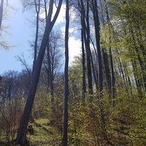
Drumul judetean 102L este neasfaltat (forestier) pana la Valea Doftanei. Undeva pe la km 28-29 apare o bifurcatie secundara mai ingusta decat drumul pe care veniti si care urca spre stalpii de inalta trensiune. Acela este inceputul celui mai greu urcus. Ca sa nu va rataciti tineti drumul principal pana la bifurcatia aceea apoi urmariti traseul stalpilor de tensiune. Intrebati ori de cate ori va intalniti cu cineva. Aveti apa pe tot traseul.
- -:--
- Duration
- 75.4 km
- Distance
- 761 m
- Ascent
- 897 m
- Descent
- ---
- Avg. speed
- ---
- Max. altitude
Continue with Bikemap
Use, edit, or download this cycling route
You would like to ride bv - campina or customize it for your own trip? Here is what you can do with this Bikemap route:
Free features
- Save this route as favorite or in collections
- Copy & plan your own version of this route
- Sync your route with Garmin or Wahoo
Premium features
Free trial for 3 days, or one-time payment. More about Bikemap Premium.
- Navigate this route on iOS & Android
- Export a GPX / KML file of this route
- Create your custom printout (try it for free)
- Download this route for offline navigation
Discover more Premium features.
Get Bikemap PremiumFrom our community
Other popular routes starting in Brasov
 Strada Jepilor, nr. 34, Braşov to Strada Mestecăniș, nr. 1, Braşov
- Distance
- 37 km
- Ascent
- 2,458 m
- Descent
- 2,458 m
- Location
- Brasov, Brașov County, Romania
 Brasov - Sf. Gheorghe - Baraolt - Brasov
- Distance
- 127.4 km
- Ascent
- 2,118 m
- Descent
- 1,577 m
- Location
- Brasov, Brașov County, Romania
 Blumana-Noua-Forestier Crucur-Timisul de Jos și retur
- Distance
- 31.2 km
- Ascent
- 564 m
- Descent
- 601 m
- Location
- Brasov, Brașov County, Romania
 Valea cu apa din Saua Tampei 09.07.2013
- Distance
- 18 km
- Ascent
- 726 m
- Descent
- 728 m
- Location
- Brasov, Brașov County, Romania
 Easy ride
- Distance
- 38.5 km
- Ascent
- 572 m
- Descent
- 610 m
- Location
- Brasov, Brașov County, Romania
 Blumana-Solomon-Valea cu apă-La Bancuță-Iepure-Sub Tâmpa-Blumăna
- Distance
- 20 km
- Ascent
- 943 m
- Descent
- 882 m
- Location
- Brasov, Brașov County, Romania
 Brasov-Sibiu
- Distance
- 193.8 km
- Ascent
- 683 m
- Descent
- 801 m
- Location
- Brasov, Brașov County, Romania
 Tura de seara 03.08.2018
- Distance
- 38.1 km
- Ascent
- 68 m
- Descent
- 107 m
- Location
- Brasov, Brașov County, Romania
Open it in the app


