

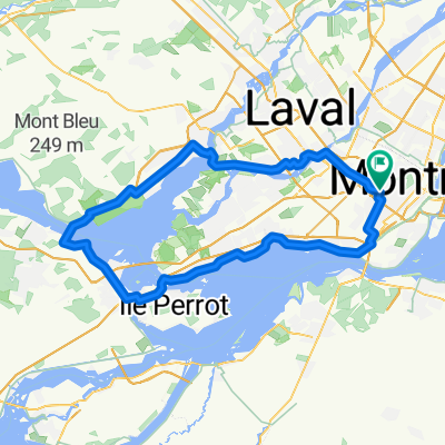
bois franc to pont viau
A cycling route starting in Saint-Laurent, Quebec, Canada.
Overview
About this route
- 1 h 25 min
- Duration
- 18.5 km
- Distance
- 2,337 m
- Ascent
- 2,338 m
- Descent
- 13 km/h
- Avg. speed
- ---
- Max. altitude
Route photos


Continue with Bikemap
Use, edit, or download this cycling route
You would like to ride bois franc to pont viau or customize it for your own trip? Here is what you can do with this Bikemap route:
Free features
- Save this route as favorite or in collections
- Copy & plan your own version of this route
- Sync your route with Garmin or Wahoo
Premium features
Free trial for 3 days, or one-time payment. More about Bikemap Premium.
- Navigate this route on iOS & Android
- Export a GPX / KML file of this route
- Create your custom printout (try it for free)
- Download this route for offline navigation
Discover more Premium features.
Get Bikemap PremiumFrom our community
Other popular routes starting in Saint-Laurent
 MTL Tour 2021
- Distance
- 129.3 km
- Ascent
- 62 m
- Descent
- 64 m
- Location
- Saint-Laurent, Quebec, Canada
 Route stable en
- Distance
- 58.1 km
- Ascent
- 196 m
- Descent
- 198 m
- Location
- Saint-Laurent, Quebec, Canada
 STL Route 7k
- Distance
- 6.7 km
- Ascent
- 24 m
- Descent
- 23 m
- Location
- Saint-Laurent, Quebec, Canada
 Route in Saint-Laurent
- Distance
- 102.7 km
- Ascent
- 286 m
- Descent
- 287 m
- Location
- Saint-Laurent, Quebec, Canada
 4640 Av Bourret, Montréal to 4640 Av Bourret, Montréal
- Distance
- 103.7 km
- Ascent
- 361 m
- Descent
- 362 m
- Location
- Saint-Laurent, Quebec, Canada
 Moderate route in Montréal
- Distance
- 16.8 km
- Ascent
- 99 m
- Descent
- 121 m
- Location
- Saint-Laurent, Quebec, Canada
 Saint-Laurent to Polytechnique
- Distance
- 8.6 km
- Ascent
- 95 m
- Descent
- 5 m
- Location
- Saint-Laurent, Quebec, Canada
 Home to Ecole Polytechnique de Montreal
- Distance
- 9.7 km
- Ascent
- 150 m
- Descent
- 12 m
- Location
- Saint-Laurent, Quebec, Canada
Open it in the app