

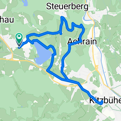
Reith -Kitz - Oberndorf - Reith
A cycling route starting in Reith bei Kitzbühel, Tyrol, Austria.
Overview
About this route
gemütliche Runde mit hartem Ende:
Zuerst geht es von Reith nach Kitzbühl auf ebenem Weg. Dort kann man einen kleinen Eindruck von der Stadt bekommen. Dann gehts auf welligem Terrain nach Oberaudorf. Schließlich fährt man von dort wieder über einen längeren Anstieg und eine rasante Abfahrt wieder nach Reith
- -:--
- Duration
- 20.7 km
- Distance
- 278 m
- Ascent
- 277 m
- Descent
- ---
- Avg. speed
- ---
- Max. altitude
Route quality
Waytypes & surfaces along the route
Waytypes
Quiet road
8.4 km
(40 %)
Access road
4.1 km
(20 %)
Surfaces
Paved
13.8 km
(66 %)
Unpaved
4.1 km
(20 %)
Asphalt
13.6 km
(65 %)
Gravel
2.2 km
(10 %)
Continue with Bikemap
Use, edit, or download this cycling route
You would like to ride Reith -Kitz - Oberndorf - Reith or customize it for your own trip? Here is what you can do with this Bikemap route:
Free features
- Save this route as favorite or in collections
- Copy & plan your own version of this route
- Sync your route with Garmin or Wahoo
Premium features
Free trial for 3 days, or one-time payment. More about Bikemap Premium.
- Navigate this route on iOS & Android
- Export a GPX / KML file of this route
- Create your custom printout (try it for free)
- Download this route for offline navigation
Discover more Premium features.
Get Bikemap PremiumFrom our community
Other popular routes starting in Reith bei Kitzbühel
 Schwarzee über St.Johann auf den Harschbichl
- Distance
- 31.2 km
- Ascent
- 1,042 m
- Descent
- 1,036 m
- Location
- Reith bei Kitzbühel, Tyrol, Austria
 ITU Kitzbuhel 2012
- Distance
- 12.3 km
- Ascent
- 992 m
- Descent
- 91 m
- Location
- Reith bei Kitzbühel, Tyrol, Austria
 Reith um den Hartkaser
- Distance
- 50.5 km
- Ascent
- 438 m
- Descent
- 438 m
- Location
- Reith bei Kitzbühel, Tyrol, Austria
 Der Weg zum Ochsen
- Distance
- 22.5 km
- Ascent
- 755 m
- Descent
- 667 m
- Location
- Reith bei Kitzbühel, Tyrol, Austria
 reith bei kitzbühel waidring steinplatte winklmoosalm reith im winkl reith bei kitzbühel
- Distance
- 86.4 km
- Ascent
- 1,531 m
- Descent
- 1,527 m
- Location
- Reith bei Kitzbühel, Tyrol, Austria
 KB-Runde von MegO, bearbeitet
- Distance
- 13.5 km
- Ascent
- 335 m
- Descent
- 335 m
- Location
- Reith bei Kitzbühel, Tyrol, Austria
 Reith-Astberg-Ellmau-Oberndorf-Kitzbühel-Kitzbüheler Horn-Kitzbühel-Münichau-Reith
- Distance
- 54.5 km
- Ascent
- 1,853 m
- Descent
- 1,853 m
- Location
- Reith bei Kitzbühel, Tyrol, Austria
 Kitzbühel
- Distance
- 9.4 km
- Ascent
- 125 m
- Descent
- 124 m
- Location
- Reith bei Kitzbühel, Tyrol, Austria
Open it in the app