

Bourne MMA to Provincetown Monument Finish
A cycling route starting in Buzzards Bay, Massachusetts, United States.
Overview
About this route
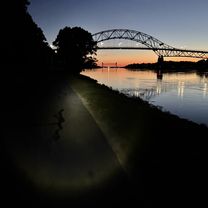
The PMC Monument Finish was previously known as the Provincetown Family Finish. The finish line is at the same location– 28 Winslow Street, Provincetown, MA. Riders begin by crossing the Bourne Bridge. From there, it is a combination of rolling hills and flats until they reach Truro. Once there, riders face several short, but fairly steep climbs. Riders then have a few more miles of rolling terrain before finishing at the Provincetown Monument. This ride begins at sun up and depending on pace and rest times, can last from 3.5 hours to 9 hours. Most riders arrive in Provincetown between 10 am and 12:45 p.m.
- -:--
- Duration
- 125.4 km
- Distance
- 659 m
- Ascent
- 657 m
- Descent
- ---
- Avg. speed
- ---
- Max. altitude
Route quality
Waytypes & surfaces along the route
Waytypes
Road
36.4 km
(29 %)
Cycleway
31.4 km
(25 %)
Surfaces
Paved
79 km
(63 %)
Unpaved
1.3 km
(1 %)
Asphalt
76.5 km
(61 %)
Paved (undefined)
1.3 km
(1 %)
Continue with Bikemap
Use, edit, or download this cycling route
You would like to ride Bourne MMA to Provincetown Monument Finish or customize it for your own trip? Here is what you can do with this Bikemap route:
Free features
- Save this route as favorite or in collections
- Copy & plan your own version of this route
- Split it into stages to create a multi-day tour
- Sync your route with Garmin or Wahoo
Premium features
Free trial for 3 days, or one-time payment. More about Bikemap Premium.
- Navigate this route on iOS & Android
- Export a GPX / KML file of this route
- Create your custom printout (try it for free)
- Download this route for offline navigation
Discover more Premium features.
Get Bikemap PremiumFrom our community
Other popular routes starting in Buzzards Bay
 PMC 2008 Day 2
- Distance
- 125.3 km
- Ascent
- 503 m
- Descent
- 496 m
- Location
- Buzzards Bay, Massachusetts, United States
 Recovered Route
- Distance
- 20.9 km
- Ascent
- 166 m
- Descent
- 136 m
- Location
- Buzzards Bay, Massachusetts, United States
 Bourne MMA to Provincetown Monument Finish
- Distance
- 125.4 km
- Ascent
- 659 m
- Descent
- 657 m
- Location
- Buzzards Bay, Massachusetts, United States
 Buzzard Bay - Going North
- Distance
- 11.5 km
- Ascent
- 24 m
- Descent
- 22 m
- Location
- Buzzards Bay, Massachusetts, United States
 cape canal bikeway -- first leg
- Distance
- 12.1 km
- Ascent
- 13 m
- Descent
- 17 m
- Location
- Buzzards Bay, Massachusetts, United States
 Sandwich to Provincetown
- Distance
- 151.6 km
- Ascent
- 267 m
- Descent
- 255 m
- Location
- Buzzards Bay, Massachusetts, United States
 Cape Cod Canal Bikeway
- Distance
- 11.4 km
- Ascent
- 41 m
- Descent
- 40 m
- Location
- Buzzards Bay, Massachusetts, United States
 Canal Service Rd, Buzzards Bay to Canal Service Rd, Buzzards Bay
- Distance
- 14.8 km
- Ascent
- 34 m
- Descent
- 35 m
- Location
- Buzzards Bay, Massachusetts, United States
Open it in the app