Ferien tag 5
- 43.5 km
- 378 m
- 350 m
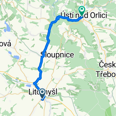
- Litomyšl, Pardubický kraj, Czechia
A cycling route starting in Litomyšl, Pardubický kraj, Czechia.
Overview
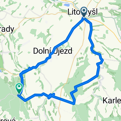
A two-day challenging circular route on good paved roads, 275 km and 3,760 meters of ascent. The start and end of the route is in Litomyšl at the car park near the bus station.
The first part of the journey is 129 km with about 1,400 meters of ascent. The second part of the journey is 146 km with about 2,360 meters of ascent.
From Litomyšl, along the C182, we ascend near the Primátor campsite passing through Strakov, Janov up to Gajer, Opatovec, and via road No. 43 we ascend to Dětřichov and through Kunčín we reach Moravská Třebová. We pass under road No. 35, through Linhartice and Radkov riding through a nice flat landscape to Městečko Trnávka and further through Mezihoří, Bezděčí and Biskupice to Jaroměřice and then enter the Moravian Karst area. Via Úsobrno and the C5029 we go through Nové Sady, Horní Štěpánov, left to Buková and right to Protivanov, then Niva, Rozstání and left over Marianin to Lipovec and through Černou Skálu to Holštejn, left and along the Punkva stream to Sloup and at the tavern sharply left on the hiking trail C5/5 and descend Pustý žleb between rocks down to the Punkevní Cave, where the Punkva river springs and there is a refreshment possibility. Further, we descend along the Punkva and before the parking lot and hotel Skalní Mlýn we turn left and on C5 ascend past the Kateřinská Cave towards Balcarce, reach the road and turn left and climb to the upper bridge of the Macocha abyss. We climb up and look down. Again, we descend and continue on the road towards the Balcarka cave, on road No. 373 to the right and ascend to Vilémovice, descend to Jedovnice and there left and around the Olšovec pond we arrive at the Olšovec campsite, where we spend the night. It has all the necessary facilities, cabins, showers, restaurant and plenty of space for tents, beach and swimming possibilities.
The following day we leave the Olšovec campsite in Jedovnice and go left to Rudice, where there is a windmill and an interesting geopark. On C5119 we follow the Hradská road and at the Máchův memorial turn left and sharply descend on a forest gravel road by the spring U Srnce into the Josefské valley, right on the road to Adamov and along the railway track then right through an underpass below the tracks and climb randomly to a housing estate and continue on the road towards Brno, at the ruins of Ronov castle right and through Dlouhé vrchy to Útěchov, right to Vranov and at the end of the village left on the cycle path towards Babí lom (paved road, partly gravel), at the crossroad U Jelínka straight (again asphalt) and at the next crossroad left, here at the crossroad is an important resting place called "Lelkovadlo". From here we descend to Lelekovice and over the bridge over road No. 43 to Česká, right and on road No. 385 via Kuřin to Tišnov, right and through Lomnička, Řepka and Lomnici we ascend to Brumov, reach Černovice and ascend and descend to Chlebská, then sharply descend to Nedvědice, right and steeply and for a long time ascend to Kovářová and along C1 through Věchnov we reach Bystřice nad Pernštejnem, where at the square we have refreshments and good ice cream. From the square, we continue straight and behind the square turn right on road No. 357 towards Polička to Dalčín and Unčín where we turn right and ascend to Ubušín, left and then right to Trhovice and right through Nedvezí to Bystrá, left to Jedlová and right to Pomezí and reach road No. 34, right and after 1.2 km in the village of Květná left and from there gradually descend over Chmelík, Trstěnice, Čistá and Benátky back to Litomyšl from where we started and where we end the route.
created this 14 years ago
Route quality
Road
142.6 km
(54 %)
Quiet road
42.3 km
(16 %)
Paved
124.1 km
(47 %)
Unpaved
7.9 km
(3 %)
Asphalt
121.5 km
(46 %)
Paved (undefined)
2.6 km
(1 %)
Route highlights
propast Macocha, horní můstek
Autokemp Olšovec, Jedovnice
rybník Olšovec
větrný mlýn a geopark
Lelkovadlo, odpočicadlo
zmrzlina - točená
Continue with Bikemap
You would like to ride Litomyšl - Moravským krasem - Olšovec - Lelkovadlo - Bystřice nP - Litomyšl or customize it for your own trip? Here is what you can do with this Bikemap route:
Free trial for 3 days, or one-time payment. More about Bikemap Premium.
Discover more Premium features.
Get Bikemap PremiumFrom our community
Open it in the app