
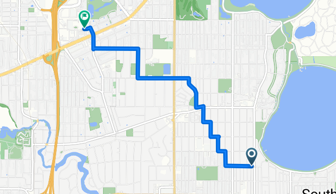
Lake Harriet to Park Nicollet
A cycling route starting in Edina, Minnesota, United States.
Overview
About this route
A low-traffic route that avoids stopsigns between Lake Harriet and Park-Nicollet Clinic
- -:--
- Duration
- 4.2 km
- Distance
- 16 m
- Ascent
- 7 m
- Descent
- ---
- Avg. speed
- 279 m
- Max. altitude
Route quality
Waytypes & surfaces along the route
Waytypes
Quiet road
3.9 km
(94 %)
Road
0.2 km
(4 %)
Pedestrian area
0.1 km
(2 %)
Surfaces
Paved
0.2 km
(5 %)
Asphalt
0.2 km
(5 %)
Undefined
3.9 km
(95 %)
Continue with Bikemap
Use, edit, or download this cycling route
You would like to ride Lake Harriet to Park Nicollet or customize it for your own trip? Here is what you can do with this Bikemap route:
Free features
- Save this route as favorite or in collections
- Copy & plan your own version of this route
- Sync your route with Garmin or Wahoo
Premium features
Free trial for 3 days, or one-time payment. More about Bikemap Premium.
- Navigate this route on iOS & Android
- Export a GPX / KML file of this route
- Create your custom printout (try it for free)
- Download this route for offline navigation
Discover more Premium features.
Get Bikemap PremiumFrom our community
Other popular routes starting in Edina
 Commute Via Creek
- Distance
- 18.3 km
- Ascent
- 107 m
- Descent
- 116 m
- Location
- Edina, Minnesota, United States
 4754 Upton to Lake City
- Distance
- 127.2 km
- Ascent
- 275 m
- Descent
- 326 m
- Location
- Edina, Minnesota, United States
 via Midtown Greenway, Park Ave
- Distance
- 13.8 km
- Ascent
- 30 m
- Descent
- 35 m
- Location
- Edina, Minnesota, United States
 Sept 9 2012 Century Ride
- Distance
- 161.2 km
- Ascent
- 334 m
- Descent
- 334 m
- Location
- Edina, Minnesota, United States
 Fun Lake Ride
- Distance
- 57 km
- Ascent
- 104 m
- Descent
- 103 m
- Location
- Edina, Minnesota, United States
 Usual Commute, updated May 2013
- Distance
- 16.2 km
- Ascent
- 100 m
- Descent
- 107 m
- Location
- Edina, Minnesota, United States
 Wisconsin Tour summary
- Distance
- 1,520 km
- Ascent
- 694 m
- Descent
- 688 m
- Location
- Edina, Minnesota, United States
 Lake Harriet - Calhoun - Greenway - River - Creek
- Distance
- 28.6 km
- Ascent
- 90 m
- Descent
- 96 m
- Location
- Edina, Minnesota, United States
Open it in the app